Area Overview for CV4 7DT
Photos of CV4 7DT
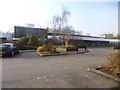
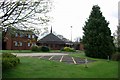
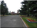
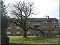
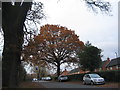
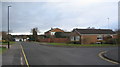
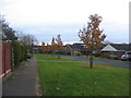
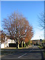
77 photos from this area
Area Information
Key information about the CV4 7DT including its size, population, and administrative classification.
- Area Type
- Postcode
- Area Size
- 2.2 hectares
- Population
- 2430
- Population Density
- 2110 people/km²
House Prices in CV4 7DT
26
Properties
£349,788
Average Sold Price
£87,500
Lowest Price
£675,000
Highest Price
Showing 26 properties
| Address | Type | Beds | Baths | Last Sale Price | Last Sale Date | |
|---|---|---|---|---|---|---|
| 108 De Montfort Way, Coventry, CV4 7DT | Bungalow | 3 | 2 | £310,500 | Feb 2025 | |
| 134 De Montfort Way, Coventry, CV4 7DT | Bungalow | - | - | £535,000 | Aug 2021 | |
| 112 De Montfort Way, Coventry, CV4 7DT | Detached | 4 | 2 | £445,000 | Feb 2021 | |
| 114 De Montfort Way, Coventry, CV4 7DT | Detached | 4 | 1 | £495,000 | Jul 2018 | |
| 126 De Montfort Way, Coventry, CV4 7DT | Detached | 7 | 2 | £375,030 | Jul 2018 | |
| 104 De Montfort Way, Coventry, CV4 7DT | Bungalow | 3 | 1 | £375,000 | Feb 2018 | |
| 128 De Montfort Way, Coventry, CV4 7DT | Detached | 5 | 4 | £675,000 | Feb 2017 | |
| 120 De Montfort Way, Coventry, CV4 7DT | Detached | 3 | 1 | £350,000 | Sep 2015 | |
| 124A De Montfort Way, Coventry, CV4 7DT | Detached | 2 | 2 | £435,000 | Apr 2014 | |
| 116 De Montfort Way, Coventry, CV4 7DT | house | - | - | £309,000 | Oct 2009 |
Page 1 of 3
Energy Efficiency in CV4 7DT
Amenities
Schools
| Rank | School | Type | Entry gender | Ages |
|---|
Explore more schools in this area
Go to Schools tabDemographics
Household Size
One person
most common
Accommodation Type
Houses
most common
Tenure
47
majority
Ethnic Group
White
most common
Religion
N/A
most common
Household Composition
N/A
most common
Age
22
median
Young Adults (15-29 years)
most common
Household Deprivation
N/A
with no deprivation
NS-SEC
18
in Lower managerial occupations
Explore more demographic insights in this area
Go to Demographics tabPlanning
Planning Constraints
- Flood RiskPremium
- Ramsar Wetland SitesPremium
- Area of Outstanding Natural BeautyPremium
- Protected Nature ReservePremium
- Protected WoodlandPremium