Area Overview for CV4 7AQ
Photos of CV4 7AQ

Area Information
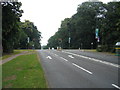
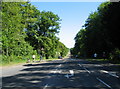
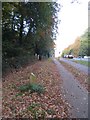
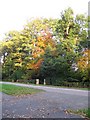
Living in CV4 7AQ means residing within a small residential cluster known as Wainbody Ward. This specific postcode covers 13.2 hectares of land in the north-west of Coventry. It forms part of the broader Westwood Heath area, which was historically part of the Stoneleigh Estate before becoming part of the city in 1927. The ward sits at coordinates 52.383418, -1.520541, placing it firmly within this established district. Despite its modest size, the area supports a population of approximately 4,120 people. The location retains a semi-rural character deep rooted in history. References to Westwood date back to 1250 in the Stoneleigh Rolls. The landscape evolved from medieval woodland to open heath and finally to farmland. The village of Westwood Heath developed around Kirby Corner in the 19th century. Central landmarks originally included a smithy, a saw mill, and the Church of St John the Baptist. This church opened in 1844 with its foundation stone laid by Chandos, Baron Leigh. The area offers a sense of place while remaining connected to the wider urban fabric of Coventry. You gain access to a neighbourhood with significant depth without the density of the city centre.
- Area Type
- Postcode
- Area Size
- 13.2 hectares
- Population
- 4120
- Population Density
- 1549 people/km²
The property market in CV4 7AQ is characterised by an overwhelmingly owner-occupied stock. Data confirms that home ownership reaches 90 percent within this specific postcode area. This figure denotes a market where residents have a clear stake in their local environment and stability. Houses form the predominant accommodation type, meaning you will find single-family dwellings rather than high-density flats or apartments. The area contains a total population of 4,120 spread across 13.2 hectares. This density results in 1,549 people per square kilometre. Such figures indicate a low-density settlement pattern typical of the Westwood Heath fringe. For buyers looking at homes in CV4 7AQ, the environment offers space and privacy. The high ownership percentage suggests that most properties have been maintained by their owners over time. There is little indication of a transient estate agent turnover in this ward. Instead, the market reflects a traditional housing stock where people stay put. This stability often translates to property values that are less volatile than in newer, rental-heavy developments.
House Prices in CV4 7AQ
Showing 18 properties
| Address | Type | Beds | Baths | Last Sale Price | Last Sale Date | |
|---|---|---|---|---|---|---|
| Southwinds, Cryfield Grange Road, Coventry, CV4 7AQ | Detached | 5 | 2 | £875,000 | Oct 2020 | |
| 8 Cryfield Grange Road, Coventry, CV4 7AQ | house | - | - | £1,975,000 | Sep 2020 | |
| Blue Cedars, Cryfield Grange Road, Coventry, CV4 7AQ | Detached | 5 | 2 | £820,000 | Oct 2017 | |
| Wyndbrow, Cryfield Grange Road, Coventry, CV4 7AQ | Detached | 7 | 7 | £1,265,000 | Jun 2016 | |
| Merton House, Cryfield Grange Road, Coventry, CV4 7AQ | Detached | 6 | 1 | £1,100,000 | May 2015 | |
| Calverton, Cryfield Grange Road, Coventry, CV4 7AQ | Detached | 5 | - | £910,000 | Feb 2014 | |
| Priors Croft, Cryfield Grange Road, Coventry, CV4 7AQ | house | - | - | £976,000 | Oct 2006 | |
| The Grange, Cryfield Grange Road, Coventry, CV4 7AQ | Detached | 7 | - | £950,000 | Jul 2004 | |
| Poynton Birches, 10 Cryfield Grange Road, Coventry, CV4 7AQ | Detached | 7 | 5 | £1,250,000 | Jun 2004 | |
| Manderley, Cryfield Grange Road, Coventry, CV4 7AQ | Detached | - | - | £138,000 | Oct 2001 |
Energy Efficiency in CV4 7AQ
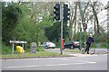
Residents of CV4 7AQ enjoy practical access to essential amenities within reasonable reach. Three major supermarkets serve the community: Tesco Cannon, Iceland Cannon, and Aldi Canon. These retailers are located sufficiently close to meet daily shopping requirements. The area also benefits from five nearby railway stations. Kenilworth Railway Station, Canley Railway Station, and Tile Hill Railway Station form a key transport node. Access to these three stations offers multiple route options for commuters leaving the ward. Convenience extends to travel options, with two airports in the surrounding vicinity. Coventry Airport is listed twice in the data, confirming its proximity to the north-west of Coventry. This network of transport links, combined with local retail chains, reduces the need to travel far for essentials. The lifestyle balances rural convenience with urban accessibility.
Amenities
Schools
Families looking for schools near CV4 7AQ will find special educational needs provisions close by. The nearest institutions listed are Wainbody Wood School, Woodfield, and another entry for Woodfield. All three schools are classed as special schools. This specific mix means the local provision is tailored to students with particular learning requirements. You do not have access to standard comprehensive primary or secondary schools in the immediate vicinity based on the available records. The presence of special schools indicates a focus on specific educational interventions for the local youth population. If you are considering homes in this area, you must account for the educational landscape of Westwood Heath. The ward does not host a broad range of standard school types. The existence of these institutions serves the community needs directly. The predominant school type is special, distinguishing this locality from areas with diverse mainstream school offerings.
| Rank | School | Type | Entry gender | Ages |
|---|
Explore more schools in this area
Go to Schools tabDemographics
The community in CV4 7AQ is defined by a young population profile. The median age here stands at 22 years, indicating that Young Adults between 15 and 29 years represent the most common age range. This demographic skew suggests a neighbourhood shaped by recent graduates and young professionals. Almost all residents own their homes, with home ownership reaching 90 percent of the total. This high figure implies a stable, long-term resident base rather than a transient rental market. The predominant accommodation type consists of Houses, reflecting the semi-rural and established nature of the estate. The population is predominantly White, aligning with the broader historical settlement patterns of the region. Safety scores reinforce the stability of the community, with a Crime Risk level of 81 out of 100. This score indicates below-average crime rates and a safer neighbourhood environment. The combination of high ownership rates and a youthful median age creates a unique social dynamic. Residents likely benefit from tight-knit community bonds formed through shared ownership and longevity in the area.
Household Size
Accommodation Type
Tenure
Ethnic Group
Religion
Household Composition
Age
Household Deprivation
NS-SEC
Explore more demographic insights in this area
Go to Demographics tabPlanning
Planning Constraints
- Flood RiskPremium
- Ramsar Wetland SitesPremium
- Area of Outstanding Natural BeautyPremium
- Protected Nature ReservePremium
- Protected WoodlandPremium