Area Overview for CV37 8SH
Photos of CV37 8SH

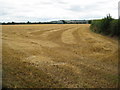

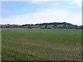

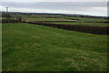
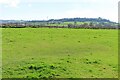
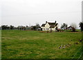
8 photos from this area
Area Information
Key information about the CV37 8SH including its size, population, and administrative classification.
- Area Type
- Postcode
- Area Size
- 19.8 hectares
- Population
- 1451
- Population Density
- 48 people/km²
House Prices in CV37 8SH
14
Properties
£316,000
Average Sold Price
£48,000
Lowest Price
£755,000
Highest Price
Showing 14 properties
| Address | Type | Beds | Baths | Last Sale Price | Last Sale Date | |
|---|---|---|---|---|---|---|
| Church Cottage, Main Street, Lower Quinton, Quinton, CV37 8SH | house | - | - | £755,000 | Jun 2024 | |
| 10, Village Cottages, Main Street, Lower Quinton, Quinton, CV37 8SH | Terraced | - | - | £145,000 | Mar 2004 | |
| 12, Village Cottages, Main Street, Lower Quinton, Quinton, CV37 8SH | Terraced | - | - | £48,000 | Oct 1996 | |
| 4 Main Street, Lower Quinton, Quinton, CV37 8SH | Detached | 4 | 3 | - | - | |
| Vicarage Farmhouse, Main Street, Lower Quinton, Quinton, CV37 8SH | Farm | 5 | 2 | - | - | |
| Kingszett, Main Street, Lower Quinton, Quinton, CV37 8SH | house | 3 | - | - | - | |
| 5 Main Street, Lower Quinton, Quinton, CV37 8SH | house | - | - | - | - | |
| College Farm, Main Street, Lower Quinton, Quinton, CV37 8SH | house | - | - | - | - | |
| Manor House, Main Street, Lower Quinton, Quinton, CV37 8SH | Detached | - | - | - | - | |
| 11, Village Cottages, Main Street, Lower Quinton, Quinton, CV37 8SH | house | - | - | - | - |
Page 1 of 2
Energy Efficiency in CV37 8SH
Amenities
Schools
| Rank | School | Type | Entry gender | Ages |
|---|
Explore more schools in this area
Go to Schools tabDemographics
Household Size
Two person
most common
Accommodation Type
Houses
most common
Tenure
74
majority
Ethnic Group
White
most common
Religion
N/A
most common
Household Composition
N/A
most common
Age
47
median
Adults (30-64 years)
most common
Household Deprivation
N/A
with no deprivation
NS-SEC
42
in Lower managerial occupations
Explore more demographic insights in this area
Go to Demographics tabPlanning
Planning Constraints
- Flood RiskPremium
- Ramsar Wetland SitesPremium
- Area of Outstanding Natural BeautyPremium
- Protected Nature ReservePremium
- Protected WoodlandPremium