Area Overview for CV37 8FG
Photos of CV37 8FG
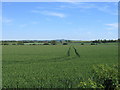


![Green lane bridleway [1] in CV37 8FG](https://images.propbar.co.uk/images/geograph/23/41/2341374_120.jpg)
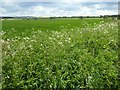
![Green lane bridleway [2] in CV37 8FG](https://images.propbar.co.uk/images/geograph/23/41/2341377_120.jpg)

13 photos from this area
Area Information
Key information about the CV37 8FG including its size, population, and administrative classification.
- Area Type
- Postcode
- Area Size
- 1.6 hectares
- Population
- 1364
- Population Density
- 63 people/km²
House Prices in CV37 8FG
29
Properties
£275,268
Average Sold Price
£119,250
Lowest Price
£685,000
Highest Price
Showing 29 properties
| Address | Type | Beds | Baths | Last Sale Price | Last Sale Date | |
|---|---|---|---|---|---|---|
| 21 Hawkins Way, Newbold On Stour, CV37 8FG | house | - | - | £280,000 | Jul 2025 | |
| 12 Hawkins Way, Newbold On Stour, CV37 8FG | Detached | 3 | 2 | £417,000 | Nov 2024 | |
| 1 Hawkins Way, Newbold On Stour, CV37 8FG | Bungalow | 3 | 2 | £685,000 | Oct 2024 | |
| 23 HAWKINS WAY, Newbold on Stour, CV37 8FG | Semi-detached | 2 | 1 | £280,000 | Aug 2023 | |
| 11 Hawkins Way, Newbold On Stour, CV37 8FG | Retail | 2 | 1 | £282,000 | Jul 2022 | |
| 24 Hawkins Way, Newbold On Stour, CV37 8FG | house | - | - | £255,000 | Jun 2020 | |
| 6 Hawkins Way, Newbold On Stour, CV37 8FG | house | - | - | £380,000 | Jan 2020 | |
| 2 Hawkins Way, Newbold On Stour, CV37 8FG | house | - | - | £418,000 | Nov 2019 | |
| 18 Hawkins Way, Newbold On Stour, CV37 8FG | Detached | 3 | 2 | £410,000 | Aug 2019 | |
| 22 Hawkins Way, Newbold On Stour, CV37 8FG | house | - | - | £255,000 | Mar 2019 |
Page 1 of 3
Energy Efficiency in CV37 8FG
Amenities
Schools
| Rank | School | Type | Entry gender | Ages |
|---|
Explore more schools in this area
Go to Schools tabDemographics
Household Size
Two person
most common
Accommodation Type
Houses
most common
Tenure
79
majority
Ethnic Group
White
most common
Religion
N/A
most common
Household Composition
N/A
most common
Age
47
median
Adults (30-64 years)
most common
Household Deprivation
N/A
with no deprivation
NS-SEC
44
in Lower managerial occupations
Explore more demographic insights in this area
Go to Demographics tabPlanning
Planning Constraints
- Flood RiskPremium
- Ramsar Wetland SitesPremium
- Area of Outstanding Natural BeautyPremium
- Protected Nature ReservePremium
- Protected WoodlandPremium