Area Overview for CV37 7TH
Photos of CV37 7TH
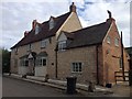
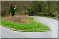
![Junction with the layby [1] in CV37 7TH](https://images.propbar.co.uk/images/geograph/53/27/5327776_120.jpg)
29 photos from this area
Area Information
Key information about the CV37 7TH including its size, population, and administrative classification.
- Area Type
- Postcode
- Area Size
- 5721 m²
- Population
- 2487
- Population Density
- 65 people/km²
House Prices in CV37 7TH
8
Properties
£414,000
Average Sold Price
£325,000
Lowest Price
£503,000
Highest Price
Showing 8 properties
| Address | Type | Beds | Baths | Last Sale Price | Last Sale Date | |
|---|---|---|---|---|---|---|
| 7 Halford Road, Ettington, CV37 7TH | Detached | - | - | £325,000 | Dec 2020 | |
| 1 Halford Road, Ettington, CV37 7TH | Detached | 5 | 3 | £503,000 | Feb 2019 | |
| Snug Cottage, Halford Road, Ettington, CV37 7TH | house | - | - | - | - | |
| 9 Halford Road, Ettington, CV37 7TH | house | - | - | - | - | |
| 5 Halford Road, Ettington, CV37 7TH | Detached | - | - | - | - | |
| 3 Halford Road, Ettington, CV37 7TH | Detached | - | - | - | - | |
| Friends Meeting House, Halford Road, Ettington, CV37 7TH | commercial | - | - | - | - | |
| New Leaf Cottage, Halford Road, Ettington, CV37 7TH | Detached | - | - | - | - |
Energy Efficiency in CV37 7TH
Amenities
Schools
| Rank | School | Type | Entry gender | Ages |
|---|
Explore more schools in this area
Go to Schools tabDemographics
Household Size
Two person
most common
Accommodation Type
Houses
most common
Tenure
81
majority
Ethnic Group
White
most common
Religion
N/A
most common
Household Composition
N/A
most common
Age
47
median
Adults (30-64 years)
most common
Household Deprivation
N/A
with no deprivation
NS-SEC
48
in Lower managerial occupations
Explore more demographic insights in this area
Go to Demographics tabPlanning
Planning Constraints
- Flood RiskPremium
- Ramsar Wetland SitesPremium
- Area of Outstanding Natural BeautyPremium
- Protected Nature ReservePremium
- Protected WoodlandPremium