Area Overview for CV37 7SS
Photos of CV37 7SS
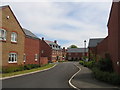
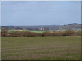
![Conservation area [1] in CV37 7SS](https://images.propbar.co.uk/images/geograph/28/39/2839899_120.jpg)
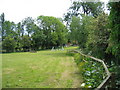
![Conservation area [2] in CV37 7SS](https://images.propbar.co.uk/images/geograph/28/39/2839908_120.jpg)
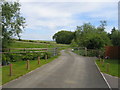
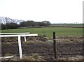
![Paths meet [1] in CV37 7SS](https://images.propbar.co.uk/images/geograph/28/40/2840102_120.jpg)
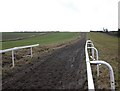
![Paths meet [2] in CV37 7SS](https://images.propbar.co.uk/images/geograph/28/40/2840116_120.jpg)
19 photos from this area
Area Information
Key information about the CV37 7SS including its size, population, and administrative classification.
- Area Type
- Postcode
- Area Size
- 26.5 hectares
- Population
- 2487
- Population Density
- 65 people/km²
House Prices in CV37 7SS
10
Properties
£282,717
Average Sold Price
£93,000
Lowest Price
£426,301
Highest Price
Showing 10 properties
| Address | Type | Beds | Baths | Last Sale Price | Last Sale Date | |
|---|---|---|---|---|---|---|
| The Nettles, Hockley Lane, Ettington, CV37 7SS | Bungalow | - | - | £420,000 | May 2012 | |
| Dillens Cottage, 1-2 Hockley Lane, Ettington, CV37 7SS | house | 3 | - | £212,000 | Mar 2010 | |
| Forge Cottage, Hockley Lane, Ettington, CV37 7SS | Cottage | 4 | 2 | £350,000 | Aug 2005 | |
| The Brambles, Hockley Lane, Ettington, CV37 7SS | Semi-detached | - | - | £426,301 | Mar 2002 | |
| April Cottage, Hockley Lane, Ettington, CV37 7SS | Semi-detached | - | - | £195,000 | Nov 2001 | |
| Orchard Cottage, Hockley Lane, Ettington, CV37 7SS | Land | - | - | £93,000 | Aug 1996 | |
| Bramblereed Cottage, Hockley Lane, Ettington, CV37 7SS | Detached | - | - | - | - | |
| 4 Hockley Lane, Ettington, CV37 7SS | house | - | - | - | - | |
| Choice, Hockley Lane, Ettington, CV37 7SS | Semi-detached | - | - | - | - | |
| Bramble Reed House, 3 Hockley Lane, Ettington, CV37 7SS | Detached | - | - | - | - |
Energy Efficiency in CV37 7SS
Amenities
Schools
| Rank | School | Type | Entry gender | Ages |
|---|
Explore more schools in this area
Go to Schools tabDemographics
Household Size
Two person
most common
Accommodation Type
Houses
most common
Tenure
81
majority
Ethnic Group
White
most common
Religion
N/A
most common
Household Composition
N/A
most common
Age
47
median
Adults (30-64 years)
most common
Household Deprivation
N/A
with no deprivation
NS-SEC
48
in Lower managerial occupations
Explore more demographic insights in this area
Go to Demographics tabPlanning
Planning Constraints
- Flood RiskPremium
- Ramsar Wetland SitesPremium
- Area of Outstanding Natural BeautyPremium
- Protected Nature ReservePremium
- Protected WoodlandPremium