Area Overview for CV37 6AG
Photos of CV37 6AG


Area Information
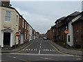
CV37 6AG is a small, tightly packed residential cluster in Stratford-upon-Avon, a historic market town in Warwickshire. The area covers 286 square metres and is home to 2,097 people, making it one of the most densely populated postcode areas in England, with 7,343,326 people per square kilometre. This compact layout reflects Stratford’s medieval origins as a planned town with a grid layout. Daily life here is shaped by its proximity to the River Avon and its status as the birthplace of William Shakespeare. The area’s character is defined by its mix of historic architecture and modern infrastructure, with a strong sense of community. Residents benefit from nearby amenities, including retail outlets, rail links, and a regional airport. While the population is small, the area’s connectivity to Stratford’s cultural and commercial hubs ensures a balance between tranquillity and accessibility. For those seeking a compact, well-served neighbourhood with historical significance, CV37 6AG offers a unique blend of heritage and practicality.
- Area Type
- Postcode
- Area Size
- 286 m²
- Population
- 2097
- Population Density
- 2671 people/km²
The property market in CV37 6AG is characterised by a high proportion of flats, with 48% of homes owned by residents. This suggests a rental market with limited owner-occupation, likely due to the area’s compact size and historical constraints on housing development. The prevalence of flats may appeal to buyers seeking smaller, manageable properties in a well-connected location. However, the small area size and high density could limit availability, making competition for properties intense. Buyers should consider the implications of living in a predominantly flat-based area, which may have different maintenance and space requirements compared to detached or semi-detached homes. The market’s dynamics are further shaped by Stratford’s status as a historic town, where property values may reflect both heritage and practicality.
House Prices in CV37 6AG
No properties found in this postcode.
Energy Efficiency in CV37 6AG
The lifestyle in CV37 6AG is shaped by its proximity to Stratford’s historic and commercial centres. Nearby amenities include five retail outlets, such as M&S Stratford and Sainsburys Bridge, offering a range of shopping and dining options. The five railway stations provide easy access to regional and national transport networks, while Wellesbourne Mountford Airport serves as a local aviation hub. The area’s compact nature means residents can access these facilities without long commutes. The presence of multiple retail points and transport links suggests a convenient, well-connected lifestyle, though the lack of parks or leisure facilities within the postcode may require residents to venture slightly beyond the immediate area for outdoor recreation.
Amenities
Schools
The nearest schools to CV37 6AG are both St Gregory’s Catholic Primary School, a primary institution. No secondary schools are listed in the data, meaning families with older children may need to look beyond the immediate area for secondary education. The presence of a single primary school suggests a limited choice for younger students, though its Catholic affiliation may align with the religious preferences of some residents. The absence of secondary schools highlights a potential challenge for families requiring a full range of educational options. However, Stratford’s broader town centre likely offers additional schooling opportunities within a short distance.
| Rank | School | Type | Entry gender | Ages |
|---|
Explore more schools in this area
Go to Schools tabDemographics
The population of CV37 6AG is predominantly adults aged 30–64, with a median age of 47. This suggests a mature, established community with a focus on stability. Home ownership rates stand at 48%, indicating a mix of owner-occupied and rental properties. The accommodation type is primarily flats, reflecting the area’s high density and likely development as part of Stratford’s historic town planning. The predominant ethnic group is White, with no data provided on other demographics. The age profile and housing stock suggest a community with limited generational turnover, where families and long-term residents predominate. This demographic structure may influence local services and amenities, with a focus on adult-oriented needs rather than childcare or youth facilities. The lack of specific diversity data means the area’s social composition remains largely unexplored in public records.
Household Size
Accommodation Type
Tenure
Ethnic Group
Religion
Household Composition
Age
Household Deprivation
NS-SEC
Explore more demographic insights in this area
Go to Demographics tabPlanning
Planning Constraints
- Flood RiskPremium
- Ramsar Wetland SitesPremium
- Area of Outstanding Natural BeautyPremium
- Protected Nature ReservePremium
- Protected WoodlandPremium