Area Overview for CV37 0TJ
Photos of CV37 0TJ


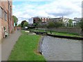
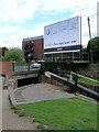
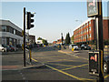
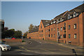
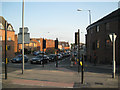

100 photos from this area
Area Information
Key information about the CV37 0TJ including its size, population, and administrative classification.
- Area Type
- Postcode
- Area Size
- 4898 m²
- Population
- 2097
- Population Density
- 2671 people/km²
House Prices in CV37 0TJ
44
Properties
£215,938
Average Sold Price
£95,000
Lowest Price
£360,000
Highest Price
Showing 44 properties
| Address | Type | Beds | Baths | Last Sale Price | Last Sale Date | |
|---|---|---|---|---|---|---|
| 32, Rookes Court, Brewery Street, Stratford Upon Avon, CV37 0TJ | Flat | 2 | 1 | £200,000 | Aug 2025 | |
| 30, Rookes Court, Brewery Street, Stratford Upon Avon, CV37 0TJ | Flat | 1 | - | £168,000 | Jul 2024 | |
| 31, Rookes Court, Brewery Street, Stratford Upon Avon, CV37 0TJ | Flat | - | - | £249,500 | Oct 2023 | |
| 34, Rookes Court, Brewery Street, Stratford Upon Avon, CV37 0TJ | Flat | 2 | 1 | £245,000 | Jun 2023 | |
| 35, Rookes Court, Brewery Street, Stratford Upon Avon, CV37 0TJ | Flat | - | - | £360,000 | Feb 2023 | |
| 42, Rookes Court, Brewery Street, Stratford Upon Avon, CV37 0TJ | Semi-detached | 3 | 2 | £315,000 | Jan 2023 | |
| 41, Rookes Court, Brewery Street, Stratford Upon Avon, CV37 0TJ | Terraced | 3 | 2 | £340,000 | Apr 2022 | |
| 39, Rookes Court, Brewery Street, Stratford Upon Avon, CV37 0TJ | Semi-detached | 3 | 2 | £350,000 | Jun 2021 | |
| 36, Rookes Court, Brewery Street, Stratford Upon Avon, CV37 0TJ | Flat | - | - | £215,000 | Aug 2019 | |
| 25, Rookes Court, Brewery Street, Stratford Upon Avon, CV37 0TJ | Flat | 1 | 1 | £135,000 | Jan 2014 |
Page 1 of 5
Energy Efficiency in CV37 0TJ
Amenities
Schools
| Rank | School | Type | Entry gender | Ages |
|---|
Explore more schools in this area
Go to Schools tabDemographics
Household Size
One person
most common
Accommodation Type
Flats
most common
Tenure
48
majority
Ethnic Group
White
most common
Religion
N/A
most common
Household Composition
N/A
most common
Age
47
median
Adults (30-64 years)
most common
Household Deprivation
N/A
with no deprivation
NS-SEC
41
in Lower managerial occupations
Explore more demographic insights in this area
Go to Demographics tabPlanning
Planning Constraints
- Flood RiskPremium
- Ramsar Wetland SitesPremium
- Area of Outstanding Natural BeautyPremium
- Protected Nature ReservePremium
- Protected WoodlandPremium