Area Overview for CV37 0SS
Photos of CV37 0SS
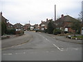

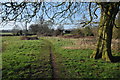


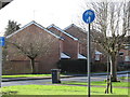


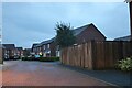
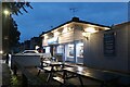
43 photos from this area
Area Information
Key information about the CV37 0SS including its size, population, and administrative classification.
- Area Type
- Postcode
- Area Size
- 1.2 hectares
- Population
- 1673
- Population Density
- 2327 people/km²
House Prices in CV37 0SS
24
Properties
£382,397
Average Sold Price
£104,000
Lowest Price
£474,995
Highest Price
Showing 24 properties
| Address | Type | Beds | Baths | Last Sale Price | Last Sale Date | |
|---|---|---|---|---|---|---|
| 6 Balmoral Grove, Stratford Upon Avon, CV37 0SS | Detached | 3 | 2 | £365,000 | Oct 2025 | |
| 25 Balmoral Grove, Stratford Upon Avon, CV37 0SS | house | - | - | £104,000 | Dec 2021 | |
| 7 Balmoral Grove, Stratford Upon Avon, CV37 0SS | house | - | - | £400,000 | Sep 2021 | |
| 9 Balmoral Grove, Stratford Upon Avon, CV37 0SS | Detached | 3 | 2 | £390,000 | Jun 2019 | |
| 1 Balmoral Grove, Stratford Upon Avon, CV37 0SS | house | - | - | £449,995 | Nov 2017 | |
| 2 Balmoral Grove, Stratford Upon Avon, CV37 0SS | house | - | - | £474,995 | Oct 2017 | |
| 4 Balmoral Grove, Stratford Upon Avon, CV37 0SS | house | - | - | £384,995 | Sep 2017 | |
| 8 Balmoral Grove, Stratford Upon Avon, CV37 0SS | Detached | 3 | 2 | £314,995 | Jul 2017 | |
| 3 Balmoral Grove, Stratford Upon Avon, CV37 0SS | house | - | - | £469,995 | Jun 2017 | |
| 5 Balmoral Grove, Stratford Upon Avon, CV37 0SS | house | - | - | £469,995 | Apr 2017 |
Page 1 of 3
Energy Efficiency in CV37 0SS
Amenities
Schools
| Rank | School | Type | Entry gender | Ages |
|---|
Explore more schools in this area
Go to Schools tabDemographics
Household Size
Family (3-5 people)
most common
Accommodation Type
Houses
most common
Tenure
70
majority
Ethnic Group
White
most common
Religion
N/A
most common
Household Composition
N/A
most common
Age
47
median
Adults (30-64 years)
most common
Household Deprivation
N/A
with no deprivation
NS-SEC
37
in Lower managerial occupations
Explore more demographic insights in this area
Go to Demographics tabPlanning
Planning Constraints
- Flood RiskPremium
- Ramsar Wetland SitesPremium
- Area of Outstanding Natural BeautyPremium
- Protected Nature ReservePremium
- Protected WoodlandPremium