Area Overview for CV37 0LF
Photos of CV37 0LF
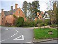
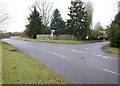
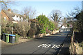
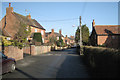

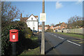
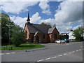


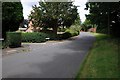

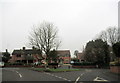
64 photos from this area
Area Information
Key information about the CV37 0LF including its size, population, and administrative classification.
- Area Type
- Postcode
- Area Size
- 11.8 hectares
- Population
- 1288
- Population Density
- 162 people/km²
House Prices in CV37 0LF
23
Properties
£474,660
Average Sold Price
£170,000
Lowest Price
£725,000
Highest Price
Showing 23 properties
| Address | Type | Beds | Baths | Last Sale Price | Last Sale Date | |
|---|---|---|---|---|---|---|
| The Lintels, Church Road, Snitterfield, CV37 0LF | Detached | 3 | 2 | £643,000 | Aug 2025 | |
| Bay Trees, Church Road, Snitterfield, CV37 0LF | Bungalow | - | - | £652,000 | May 2025 | |
| The Rodings, Church Road, Snitterfield, CV37 0LF | house | - | - | £523,000 | Jun 2021 | |
| Jasmine House, Church Road, Snitterfield, CV37 0LF | Detached | - | - | £653,357 | Aug 2018 | |
| Yewtree Cottage, Church Road, Snitterfield, CV37 0LF | Semi-detached | 3 | 1 | £385,000 | Jan 2016 | |
| Tudor House, Church Road, Snitterfield, CV37 0LF | Detached | 5 | 2 | £725,000 | Aug 2005 | |
| Sussex House, Church Road, Snitterfield, CV37 0LF | Semi-detached | 3 | - | £365,000 | Sep 2002 | |
| Pippin Lodge, Church Road, Snitterfield, CV37 0LF | house | - | - | £249,995 | Nov 2000 | |
| Mole End, Church Road, Snitterfield, CV37 0LF | Semi-detached | - | - | £170,000 | Apr 1998 | |
| Field Place, Church Road, Snitterfield, CV37 0LF | Detached | - | - | £380,251 | Aug 1996 |
Page 1 of 3
Energy Efficiency in CV37 0LF
Amenities
Schools
| Rank | School | Type | Entry gender | Ages |
|---|
Explore more schools in this area
Go to Schools tabDemographics
Household Size
Two person
most common
Accommodation Type
Houses
most common
Tenure
84
majority
Ethnic Group
White
most common
Religion
N/A
most common
Household Composition
N/A
most common
Age
47
median
Adults (30-64 years)
most common
Household Deprivation
N/A
with no deprivation
NS-SEC
51
in Lower managerial occupations
Explore more demographic insights in this area
Go to Demographics tabPlanning
Planning Constraints
- Flood RiskPremium
- Ramsar Wetland SitesPremium
- Area of Outstanding Natural BeautyPremium
- Protected Nature ReservePremium
- Protected WoodlandPremium