Area Overview for CV36 4NL
Photos of CV36 4NL
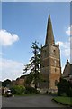

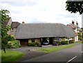
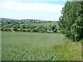
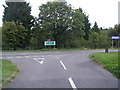
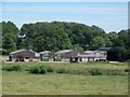
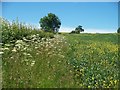
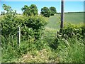
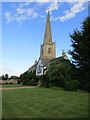
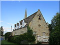
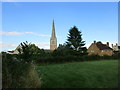
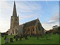
59 photos from this area
Area Information
Key information about the CV36 4NL including its size, population, and administrative classification.
- Area Type
- Postcode
- Area Size
- 1.6 hectares
- Population
- 1252
- Population Density
- 58 people/km²
House Prices in CV36 4NL
15
Properties
£612,119
Average Sold Price
£345,000
Lowest Price
£899,950
Highest Price
Showing 15 properties
| Address | Type | Beds | Baths | Last Sale Price | Last Sale Date | |
|---|---|---|---|---|---|---|
| Old Thatch, Stratford Road, Tredington, CV36 4NL | Detached | 3 | 1 | £480,000 | Oct 2025 | |
| Dene Cottage, Back Lane, Tredington, CV36 4NL | house | 3 | - | £562,500 | Sep 2022 | |
| 3, Fosse View Cottages, Village Road, Tredington, CV36 4NL | Terraced | 3 | 1 | £345,000 | Apr 2018 | |
| New Place, Back Lane, Tredington, CV36 4NL | Detached | 4 | 4 | £749,500 | Jun 2017 | |
| The Old House, Back Lane, Tredington, CV36 4NL | Detached | 5 | 3 | £899,950 | Mar 2017 | |
| Orchard Croft, Back Lane, Tredington, CV36 4NL | house | - | - | £650,000 | May 2016 | |
| Lavender House, Stratford Road, Tredington, CV36 4NL | Detached | - | - | £750,000 | Jan 2005 | |
| Wheelwrights Cottage, Church Lane, Tredington, CV36 4NL | Detached | - | - | £460,000 | Oct 2004 | |
| 1, Fosse View Cottages, Village Road, Tredington, CV36 4NL | Terraced | 2 | 1 | - | - | |
| Rosecroft, Stratford Road, Tredington, CV36 4NL | Detached | 3 | 2 | - | - |
Page 1 of 2
Energy Efficiency in CV36 4NL
Amenities
Schools
| Rank | School | Type | Entry gender | Ages |
|---|
Explore more schools in this area
Go to Schools tabDemographics
Household Size
Two person
most common
Accommodation Type
Houses
most common
Tenure
76
majority
Ethnic Group
White
most common
Religion
N/A
most common
Household Composition
N/A
most common
Age
47
median
Adults (30-64 years)
most common
Household Deprivation
N/A
with no deprivation
NS-SEC
43
in Lower managerial occupations
Explore more demographic insights in this area
Go to Demographics tabPlanning
Planning Constraints
- Flood RiskPremium
- Ramsar Wetland SitesPremium
- Area of Outstanding Natural BeautyPremium
- Protected Nature ReservePremium
- Protected WoodlandPremium