Area Overview for CV36 4LR
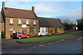
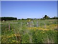
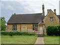
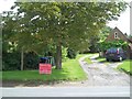
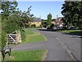
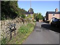
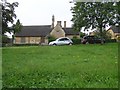
Photos of CV36 4LR

Area Information
Living in CV36 4LR offers a clear sense of the stabilising demographic found within a specific residential cluster in England. This postcode covers a land area of 5,390 square metres, hosting 1,364 residents. You will find yourself in a neighbourhood defined by its quiet, residential nature rather than commercial bustle. The settlement attracts buyers seeking a home environment with established character. Daily life here revolves around local amenities and a strong sense of community, as the population density sits at just 63 people per square kilometre. This figure indicates each household has significant space in its immediate vicinity. The area functions as a self-contained base for those who value proximity to services over the anonymity of a large city. You access practical conveniences like shops and rail links that meet everyday needs without the noise of major urban centres. The district reflects a stable settlement where residents appreciate the balance between housing stock and available space.
- Area Type
- Postcode
- Area Size
- 5390 m²
- Population
- 1364
- Population Density
- 63 people/km²
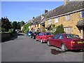
You are looking at a property market in CV36 4LR defined by traditional housing stock and high ownership rates. With 79 per cent of homes owned by their occupants, the area is primarily an owner-occupied market rather than a renting or student-led district. Houses make up the accommodation type, providing detached or semi-detached options typical of settled villages. This structure means you will find fewer purpose-built apartment blocks compared to urban centres. Buyers seeking a standalone property will have the majority of the market open to them. The high ownership figure suggests that properties here often change hands less frequently, leading to a market driven by long-term residents. When viewing homes in CV36 4LR, expect to see well-maintained properties suited to families and those who value privacy. The local estate agency landscape likely supports this existing stock rather than pushing rapid development or new builds.
House Prices in CV36 4LR
Showing 5 properties
| Address | Type | Beds | Baths | Last Sale Price | Last Sale Date | |
|---|---|---|---|---|---|---|
| Inglenook Cottage, 2 Ballards Lane, Ilmington, CV36 4LR | house | - | - | £840,000 | Jun 2020 | |
| No 1 Manor Cottages, Ballards Lane, Ilmington, CV36 4LR | Terraced | - | - | - | - | |
| Little Owl Cottage, Ballards Lane, Ilmington, CV36 4LR | Detached | - | - | - | - | |
| The Cottage, Ballards Lane, Ilmington, CV36 4LR | Detached | - | - | - | - | |
| The Gatehouse, Ballards Lane, Ilmington, CV36 4LR | house | - | - | - | - |
Energy Efficiency in CV36 4LR
Your daily routine in CV36 4LR benefits from a short walk to essential retail and transport options. The area includes five notable amenities within practical reach, ensuring you do not need to travel far for groceries or daily essentials. Morrisons Daily, Morrisons Daily Shipston-on, and Tesco Shipston form the core of your retail needs. These superstores provide a full range of groceries and household goods under one cover. For local bus services or commuter trains, Honeybourne Railway Station offers exactly one rail option nearby. This station connects your home to broader networks, bridging the gap between a rural setting and city life. The proximity of these specific shops means your morning shopping trip takes minimal time. You enjoy the convenience of major supermarket chains without the congestion of high street shopping entirely.
Amenities
Schools
For families residing in CV36 4LR, the local education landscape offers specific choices starting from early years. Ilmington CofE Primary School sits nearby as a primary institution holding a good Ofsted rating. This school provides a formal educational environment with recognised standards. You also have access to Newbold-On-Stour Junior and Infant School, another primary option serving the younger cohort. The mix of schools indicates a network catering to local families with children in the initial phases of their education. Both institutions are situated within practical reach, reducing travel time to school gates. While secondary options are not listed for this immediate cluster, the presence of these two rated schools suggests a parental community. You should check catchment areas carefully if you intend to use these particular institutions for your children.
| Rank | School | Type | Entry gender | Ages |
|---|
Explore more schools in this area
Go to Schools tabDemographics
The community profile of CV36 4LR is dominated by adults between the ages of 30 and 64 years. This age group represents the most common bracket within the population, suggesting families and established professionals form the core of the neighbour. You will see a median age of 47 years across the area, reinforcing the picture of an older, settled demographic. Home ownership stands at a high level of 79 per cent, meaning most people have bought their properties outright or through a mortgage. Houses serve as the primary accommodation type throughout CV36 4LR, with very few flats available for purchase. The predominant ethnic group is White, mirroring the historical settlement patterns of the surrounding countryside. You are entering a market where buyers have typically stayed for decades, rather than viewing homes as short-term investments. This stability creates a predictable environment for new residents joining the local community.
Household Size
Accommodation Type
Tenure
Ethnic Group
Religion
Household Composition
Age
Household Deprivation
NS-SEC
Explore more demographic insights in this area
Go to Demographics tabPlanning
Planning Constraints
- Flood RiskPremium
- Ramsar Wetland SitesPremium
- Area of Outstanding Natural BeautyPremium
- Protected Nature ReservePremium
- Protected WoodlandPremium