Area Overview for CV36 4HL
Photos of CV36 4HL


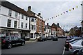

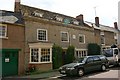
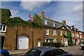
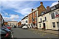
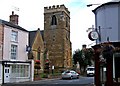

100 photos from this area
Area Information
Key information about the CV36 4HL including its size, population, and administrative classification.
- Area Type
- Postcode
- Area Size
- 1.1 hectares
- Population
- 1605
- Population Density
- 3201 people/km²
House Prices in CV36 4HL
24
Properties
£260,158
Average Sold Price
£43,000
Lowest Price
£475,000
Highest Price
Showing 24 properties
| Address | Type | Beds | Baths | Last Sale Price | Last Sale Date | |
|---|---|---|---|---|---|---|
| 8 Hanson Avenue, Shipston On Stour, CV36 4HL | house | 4 | 1 | £375,000 | Dec 2024 | |
| 14 Hanson Avenue, Shipston On Stour, CV36 4HL | house | - | - | £435,000 | Aug 2024 | |
| 3 Hanson Avenue, Shipston On Stour, CV36 4HL | house | - | - | £475,000 | Jun 2023 | |
| 26 Hanson Avenue, Shipston On Stour, CV36 4HL | house | - | - | £364,000 | Jan 2023 | |
| 12 Hanson Avenue, Shipston On Stour, CV36 4HL | house | - | - | £448,000 | Oct 2022 | |
| 6 Hanson Avenue, Shipston On Stour, CV36 4HL | Detached | 4 | 1 | £310,000 | Feb 2017 | |
| 20 Hanson Avenue, Shipston On Stour, CV36 4HL | Semi-detached | 3 | 1 | £225,000 | Dec 2016 | |
| 1 Hanson Avenue, Shipston On Stour, CV36 4HL | Detached | 3 | - | £239,000 | Dec 2015 | |
| 15 Hanson Avenue, Shipston On Stour, CV36 4HL | Detached | 4 | - | £295,000 | May 2015 | |
| 16 Hanson Avenue, Shipston On Stour, CV36 4HL | Detached | 4 | - | £250,000 | Aug 2012 |
Page 1 of 3
Energy Efficiency in CV36 4HL
Amenities
Schools
| Rank | School | Type | Entry gender | Ages |
|---|
Explore more schools in this area
Go to Schools tabDemographics
Household Size
Two person
most common
Accommodation Type
Houses
most common
Tenure
60
majority
Ethnic Group
White
most common
Religion
N/A
most common
Household Composition
N/A
most common
Age
47
median
Adults (30-64 years)
most common
Household Deprivation
N/A
with no deprivation
NS-SEC
30
in Lower managerial occupations
Explore more demographic insights in this area
Go to Demographics tabPlanning
Planning Constraints
- Flood RiskPremium
- Ramsar Wetland SitesPremium
- Area of Outstanding Natural BeautyPremium
- Protected Nature ReservePremium
- Protected WoodlandPremium