Area Overview for CV36 4HD
Photos of CV36 4HD


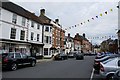

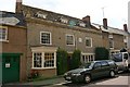


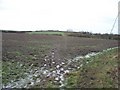
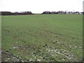

100 photos from this area
Area Information
Key information about the CV36 4HD including its size, population, and administrative classification.
- Area Type
- Postcode
- Area Size
- 7067 m²
- Population
- 1605
- Population Density
- 3201 people/km²
House Prices in CV36 4HD
28
Properties
£219,100
Average Sold Price
£95,000
Lowest Price
£355,000
Highest Price
Showing 28 properties
| Address | Type | Beds | Baths | Last Sale Price | Last Sale Date | |
|---|---|---|---|---|---|---|
| 20 West Street, Shipston On Stour, CV36 4HD | house | - | - | £335,000 | Sep 2021 | |
| 45 West Street, Shipston On Stour, CV36 4HD | Terraced | 3 | 1 | £260,000 | Jan 2019 | |
| 43 West Street, Shipston On Stour, CV36 4HD | house | - | - | £216,000 | Sep 2018 | |
| 21 West Street, Shipston On Stour, CV36 4HD | Terraced | 2 | 1 | £171,000 | Nov 2017 | |
| 13 West Street, Shipston On Stour, CV36 4HD | Terraced | 2 | - | £174,000 | Oct 2014 | |
| The Old Kiln House, 8 West Street, Shipston On Stour, CV36 4HD | Character Property | 4 | 4 | £355,000 | Dec 2010 | |
| 31 West Street, Shipston On Stour, CV36 4HD | house | - | - | £145,000 | Dec 2009 | |
| 16 West Street, Shipston On Stour, CV36 4HD | Terraced | - | - | £170,000 | Jun 2007 | |
| 23 West Street, Shipston On Stour, CV36 4HD | Terraced | - | - | £95,000 | Sep 2002 | |
| The Flat, 24 West Street, Shipston On Stour, CV36 4HD | Flat | 2 | - | £270,000 | Apr 2000 |
Page 1 of 3
Energy Efficiency in CV36 4HD
Amenities
Schools
| Rank | School | Type | Entry gender | Ages |
|---|
Explore more schools in this area
Go to Schools tabDemographics
Household Size
Two person
most common
Accommodation Type
Houses
most common
Tenure
60
majority
Ethnic Group
White
most common
Religion
N/A
most common
Household Composition
N/A
most common
Age
47
median
Adults (30-64 years)
most common
Household Deprivation
N/A
with no deprivation
NS-SEC
30
in Lower managerial occupations
Explore more demographic insights in this area
Go to Demographics tabPlanning
Planning Constraints
- Flood RiskPremium
- Ramsar Wetland SitesPremium
- Area of Outstanding Natural BeautyPremium
- Protected Nature ReservePremium
- Protected WoodlandPremium