Area Overview for CV35 9UB
Photos of CV35 9UB
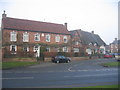


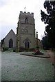
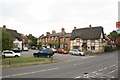
100 photos from this area
Area Information
Key information about the CV35 9UB including its size, population, and administrative classification.
- Area Type
- Postcode
- Area Size
- 3898 m²
- Population
- 1419
- Population Density
- 2785 people/km²
House Prices in CV35 9UB
8
Properties
£321,312
Average Sold Price
£187,495
Lowest Price
£545,000
Highest Price
Showing 8 properties
| Address | Type | Beds | Baths | Last Sale Price | Last Sale Date | |
|---|---|---|---|---|---|---|
| 71 Warwick Road, Wellesbourne, CV35 9UB | house | 4 | 2 | £545,000 | Dec 2023 | |
| 63 Warwick Road, Wellesbourne, CV35 9UB | house | 4 | - | £380,000 | Dec 2020 | |
| 61 Warwick Road, Wellesbourne, CV35 9UB | Detached | 4 | - | £305,000 | Nov 2013 | |
| 67 Warwick Road, Wellesbourne, CV35 9UB | house | 4 | - | £340,000 | Aug 2010 | |
| 69 Warwick Road, Wellesbourne, CV35 9UB | Detached | - | - | £320,000 | Sep 2006 | |
| 73 Warwick Road, Wellesbourne, CV35 9UB | Detached | - | - | £243,000 | May 2003 | |
| 75 Warwick Road, Wellesbourne, CV35 9UB | Detached | 4 | 2 | £249,999 | Aug 2002 | |
| 65 Warwick Road, Wellesbourne, CV35 9UB | house | - | - | £187,495 | Mar 2000 |
Energy Efficiency in CV35 9UB
Amenities
Schools
| Rank | School | Type | Entry gender | Ages |
|---|
Explore more schools in this area
Go to Schools tabDemographics
Household Size
Two person
most common
Accommodation Type
Houses
most common
Tenure
66
majority
Ethnic Group
White
most common
Religion
N/A
most common
Household Composition
N/A
most common
Age
47
median
Adults (30-64 years)
most common
Household Deprivation
N/A
with no deprivation
NS-SEC
41
in Lower managerial occupations
Explore more demographic insights in this area
Go to Demographics tabPlanning
Planning Constraints
- Flood RiskPremium
- Ramsar Wetland SitesPremium
- Area of Outstanding Natural BeautyPremium
- Protected Nature ReservePremium
- Protected WoodlandPremium