Area Overview for CV35 8TU
Photos of CV35 8TU

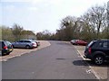
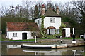
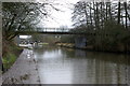


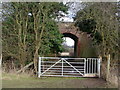
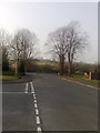

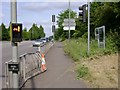
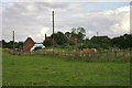
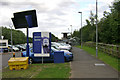
100 photos from this area
Area Information
Key information about the CV35 8TU including its size, population, and administrative classification.
- Area Type
- Postcode
- Area Size
- 10.0 hectares
- Population
- 2794
- Population Density
- 564 people/km²
House Prices in CV35 8TU
30
Properties
£250,711
Average Sold Price
£71,500
Lowest Price
£425,000
Highest Price
Showing 30 properties
| Address | Type | Beds | Baths | Last Sale Price | Last Sale Date | |
|---|---|---|---|---|---|---|
| 27 Gould Road, Hampton Magna, Budbrooke, CV35 8TU | Detached | 4 | 3 | £400,000 | May 2024 | |
| 2 Gould Road, Hampton Magna, Budbrooke, CV35 8TU | house | - | - | £270,000 | Nov 2023 | |
| 20 Gould Road, Hampton Magna, Budbrooke, CV35 8TU | house | - | - | £286,000 | Oct 2021 | |
| 19 Gould Road, Hampton Magna, Budbrooke, CV35 8TU | Detached | 3 | 1 | £325,000 | Sep 2021 | |
| 22 Gould Road, Hampton Magna, Budbrooke, CV35 8TU | Detached | 3 | 1 | £323,750 | Jul 2021 | |
| 21 Gould Road, Hampton Magna, Budbrooke, CV35 8TU | Detached | 3 | - | £325,000 | Jul 2021 | |
| 15 Gould Road, Hampton Magna, Budbrooke, CV35 8TU | house | - | - | £309,950 | Jun 2021 | |
| 30 Gould Road, Hampton Magna, Budbrooke, CV35 8TU | Bungalow | 3 | - | £425,000 | May 2021 | |
| 28 Gould Road, Hampton Magna, Budbrooke, CV35 8TU | Bungalow | 3 | 2 | £321,000 | Feb 2021 | |
| 24 Gould Road, Hampton Magna, Budbrooke, CV35 8TU | Bungalow | 3 | 1 | £280,000 | Jul 2019 |
Page 1 of 3
Energy Efficiency in CV35 8TU
Amenities
Schools
| Rank | School | Type | Entry gender | Ages |
|---|
Explore more schools in this area
Go to Schools tabDemographics
Household Size
Family (3-5 people)
most common
Accommodation Type
Houses
most common
Tenure
70
majority
Ethnic Group
White
most common
Religion
N/A
most common
Household Composition
N/A
most common
Age
47
median
Adults (30-64 years)
most common
Household Deprivation
N/A
with no deprivation
NS-SEC
49
in Lower managerial occupations
Explore more demographic insights in this area
Go to Demographics tabPlanning
Planning Constraints
- Flood RiskPremium
- Ramsar Wetland SitesPremium
- Area of Outstanding Natural BeautyPremium
- Protected Nature ReservePremium
- Protected WoodlandPremium