Area Overview for CV35 8TB
Photos of CV35 8TB

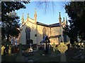
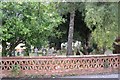
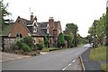
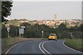
41 photos from this area
Area Information
Key information about the CV35 8TB including its size, population, and administrative classification.
- Area Type
- Postcode
- Area Size
- 9475 m²
- Population
- 1746
- Population Density
- 155 people/km²
House Prices in CV35 8TB
25
Properties
£216,017
Average Sold Price
£54,000
Lowest Price
£401,000
Highest Price
Showing 25 properties
| Address | Type | Beds | Baths | Last Sale Price | Last Sale Date | |
|---|---|---|---|---|---|---|
| 13 Dorchester Avenue, Hampton Magna, Budbrooke, CV35 8TB | Bungalow | 2 | 1 | £340,000 | Jun 2024 | |
| 14 Dorchester Avenue, Hampton Magna, Budbrooke, CV35 8TB | Semi-detached | 3 | 1 | £317,500 | Aug 2023 | |
| 19 Dorchester Avenue, Hampton Magna, Budbrooke, CV35 8TB | Semi-detached | 4 | 2 | £401,000 | Sep 2022 | |
| 11 Dorchester Avenue, Hampton Magna, Budbrooke, CV35 8TB | Bungalow | - | - | £360,000 | Jul 2022 | |
| 25 Dorchester Avenue, Hampton Magna, Budbrooke, CV35 8TB | Bungalow | 2 | - | £235,000 | Oct 2015 | |
| 30 Dorchester Avenue, Hampton Magna, Budbrooke, CV35 8TB | house | - | - | £207,500 | May 2011 | |
| 27 Dorchester Avenue, Hampton Magna, Budbrooke, CV35 8TB | Semi-detached | - | - | £210,200 | May 2007 | |
| 34 Dorchester Avenue, Hampton Magna, Budbrooke, CV35 8TB | Semi-detached | 3 | 2 | £183,000 | Jun 2006 | |
| 15 Dorchester Avenue, Hampton Magna, Budbrooke, CV35 8TB | Semi-detached | - | - | £108,000 | Oct 2000 | |
| 23 Dorchester Avenue, Hampton Magna, Budbrooke, CV35 8TB | Bungalow | 2 | 1 | £109,000 | Aug 2000 |
Page 1 of 3
Energy Efficiency in CV35 8TB
Amenities
Schools
| Rank | School | Type | Entry gender | Ages |
|---|
Explore more schools in this area
Go to Schools tabDemographics
Household Size
Two person
most common
Accommodation Type
Houses
most common
Tenure
88
majority
Ethnic Group
White
most common
Religion
N/A
most common
Household Composition
N/A
most common
Age
47
median
Adults (30-64 years)
most common
Household Deprivation
N/A
with no deprivation
NS-SEC
47
in Lower managerial occupations
Explore more demographic insights in this area
Go to Demographics tabPlanning
Planning Constraints
- Flood RiskPremium
- Ramsar Wetland SitesPremium
- Area of Outstanding Natural BeautyPremium
- Protected Nature ReservePremium
- Protected WoodlandPremium