Area Overview for CV35 7DP
Photos of CV35 7DP


Area Information
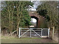
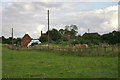
CV35 7DP is a small residential postcode in Warwickshire, England, encompassing the village of Budbrooke and the Hampton Magna housing estate. The area has a population of 2,612, with a density of 304 people per square kilometre, reflecting a compact, community-focused cluster. Historically, Budbrooke was a medieval village that shrank after the Black Death, with its original settlement now near St Michael’s Church, a 12th-century structure. Today, the area is dominated by the Hampton Magna estate, built in the late 1960s on the site of former military barracks. This blend of rural heritage and post-war housing creates a distinct character: quiet, low-density living with easy access to nearby Warwick, 3 miles east. Residents benefit from proximity to the Grand Union Canal, A-roads, and motorways like the M40. The area’s small size means it is tightly knit, with a focus on local amenities and a slower pace of life compared to larger towns. For buyers, it offers a mix of traditional village charm and modern suburban convenience, ideal for those seeking a peaceful yet connected lifestyle.
- Area Type
- Postcode
- Area Size
- Not available
- Population
- 2612
- Population Density
- 304 people/km²
The property market in CV35 7DP is characterised by high home ownership (78%) and a focus on houses rather than flats or apartments. This indicates a market skewed towards owner-occupation, with limited rental activity. The housing stock reflects the area’s history: the Hampton Magna estate, built in the late 1960s, dominates, offering mid-century suburban homes. Given the small size of the postcode, the property choices are limited to this cluster, with no indication of newer developments or a diverse range of housing types. For buyers, this means a niche market with fixed supply. The area’s appeal lies in its quiet, rural setting and proximity to Warwick, but the lack of variety in property types may limit options for those seeking specific features like modern builds or larger homes. Buyers should consider the estate’s age and the potential for future expansion in nearby areas.
House Prices in CV35 7DP
Showing 1 properties
| Address | Type | Beds | Baths | Last Sale Price | Last Sale Date | |
|---|---|---|---|---|---|---|
| Warwickshire County Council, Old Budbrooke Road, Budbrooke, CV35 7DP | office_workshop | - | - | - | - |
Energy Efficiency in CV35 7DP
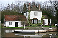
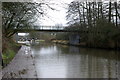
The lifestyle in CV35 7DP is shaped by its proximity to natural and retail amenities. Nearby retail options include M&S Budbrooke South BP, Co-op Cape, and Sainsburys Warwick, providing essential shopping and services within reach. The area’s rural character is complemented by the Grand Union Canal, which runs through the parish, offering opportunities for walking, cycling, and leisure. The historic St Michael’s Church and nearby earthworks of the medieval village add cultural and historical interest. While the data does not specify parks or recreational facilities, the canal and surrounding green spaces likely contribute to a relaxed, outdoor-oriented lifestyle. The mix of retail, transport, and natural features creates a convenient yet tranquil environment, ideal for those seeking a balance between convenience and tranquillity.
Amenities
Schools
The schools near CV35 7DP include Budbrooke Primary School, The Ferncumbe CofE Primary School, and Hatton Junior and Infant School. All are primary schools, with Budbrooke Primary School holding an Ofsted rating of ‘good’. This mix of schools provides families with multiple options for early education, though no secondary schools are listed in the data. The presence of three primary schools suggests a well-served local community, with two schools located in the immediate area (Budbrooke and The Ferncumbe) and one slightly further afield (Hatton). The ‘good’ rating at Budbrooke Primary School indicates a school performing above average, which is a positive sign for families prioritising quality education. However, the absence of secondary school data means parents may need to consider commuting to nearby towns like Warwick for secondary education.
| Rank | School | Type | Entry gender | Ages |
|---|
Explore more schools in this area
Go to Schools tabDemographics
The population of CV35 7DP has a median age of 47, with the majority of residents aged between 30 and 64. This suggests a stable, mature community with a strong presence of working-age adults. Home ownership is high at 78%, indicating a predominantly owner-occupied area rather than a rental market. The accommodation type is primarily houses, reflecting a suburban or rural housing stock rather than flats or apartments. The predominant ethnic group is White, with no specific data on other demographics provided. The age profile and home ownership figures suggest a community that is largely self-sufficient, with fewer young families or students compared to other areas. The absence of detailed diversity data means the area’s social composition remains relatively homogeneous, though this does not necessarily indicate deprivation—rather, it aligns with the demographic trends of a small, rural postcode.
Household Size
Accommodation Type
Tenure
Ethnic Group
Religion
Household Composition
Age
Household Deprivation
NS-SEC
Explore more demographic insights in this area
Go to Demographics tabPlanning
Planning Constraints
- Flood RiskPremium
- Ramsar Wetland SitesPremium
- Area of Outstanding Natural BeautyPremium
- Protected Nature ReservePremium
- Protected WoodlandPremium