Area Overview for CV35 0TF
Photos of CV35 0TF
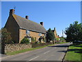
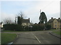
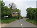
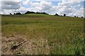
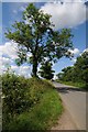
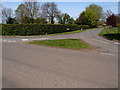
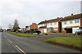
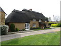
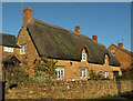
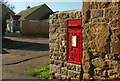
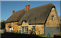
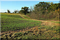
55 photos from this area
Area Information
Key information about the CV35 0TF including its size, population, and administrative classification.
- Area Type
- Postcode
- Area Size
- 9122 m²
- Population
- 2421
- Population Density
- 45 people/km²
House Prices in CV35 0TF
12
Properties
£396,826
Average Sold Price
£231,231
Lowest Price
£655,000
Highest Price
Showing 12 properties
| Address | Type | Beds | Baths | Last Sale Price | Last Sale Date | |
|---|---|---|---|---|---|---|
| 5 Old Tree Lane, Upper Tysoe, CV35 0TF | house | - | - | £375,000 | Apr 2022 | |
| The Willows, Old Tree Lane, Upper Tysoe, CV35 0TF | Detached | 4 | - | £655,000 | Sep 2021 | |
| Old Tree Cottage, Old Tree Lane, Upper Tysoe, CV35 0TF | house | - | - | £341,550 | Oct 2020 | |
| 1 Old Tree Lane, Upper Tysoe, CV35 0TF | house | 2 | - | £231,231 | Aug 2019 | |
| 2 Old Tree Lane, Upper Tysoe, CV35 0TF | house | - | - | £250,000 | Aug 2018 | |
| The Anchorage, Old Tree Lane, Upper Tysoe, CV35 0TF | house | - | - | £435,000 | Feb 2016 | |
| 7 Old Tree Lane, Upper Tysoe, CV35 0TF | house | - | - | £490,000 | Oct 2015 | |
| The Barn, Old Tree Lane, Upper Tysoe, CV35 0TF | Detached | - | - | - | - | |
| 6 Old Tree Lane, Upper Tysoe, CV35 0TF | house | - | - | - | - | |
| 4 Old Tree Lane, Upper Tysoe, CV35 0TF | house | - | - | - | - |
Page 1 of 2
Energy Efficiency in CV35 0TF
Amenities
Schools
| Rank | School | Type | Entry gender | Ages |
|---|
Explore more schools in this area
Go to Schools tabDemographics
Household Size
Two person
most common
Accommodation Type
Houses
most common
Tenure
78
majority
Ethnic Group
White
most common
Religion
N/A
most common
Household Composition
N/A
most common
Age
47
median
Adults (30-64 years)
most common
Household Deprivation
N/A
with no deprivation
NS-SEC
45
in Lower managerial occupations
Explore more demographic insights in this area
Go to Demographics tabPlanning
Planning Constraints
- Flood RiskPremium
- Ramsar Wetland SitesPremium
- Area of Outstanding Natural BeautyPremium
- Protected Nature ReservePremium
- Protected WoodlandPremium