Area Overview for CV35 0LH
Photos of CV35 0LH
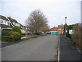
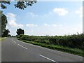
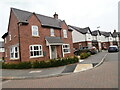
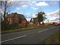
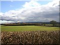
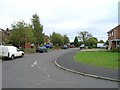
6 photos from this area
Area Information
Key information about the CV35 0LH including its size, population, and administrative classification.
- Area Type
- Postcode
- Area Size
- 3.2 hectares
- Population
- 1834
- Population Density
- 71 people/km²
House Prices in CV35 0LH
41
Properties
£244,564
Average Sold Price
£75,000
Lowest Price
£380,000
Highest Price
Showing 41 properties
| Address | Type | Beds | Baths | Last Sale Price | Last Sale Date | |
|---|---|---|---|---|---|---|
| 22 Shortacres, Kineton, CV35 0LH | Detached | 3 | 1 | £291,000 | Jul 2025 | |
| 24 Shortacres, Kineton, CV35 0LH | house | - | - | £340,000 | Feb 2024 | |
| 23 Shortacres, Kineton, CV35 0LH | house | - | - | £355,000 | Apr 2023 | |
| 17 Shortacres, Kineton, CV35 0LH | house | - | - | £380,000 | Jul 2022 | |
| 30 Shortacres, Kineton, CV35 0LH | house | - | - | £352,030 | Dec 2020 | |
| 26 Shortacres, Kineton, CV35 0LH | house | - | - | £332,500 | Jun 2020 | |
| 16 Shortacres, Kineton, CV35 0LH | Detached | 4 | - | £325,000 | Jun 2019 | |
| 20 Shortacres, Kineton, CV35 0LH | Bungalow | - | - | £300,000 | May 2019 | |
| 33 Shortacres, Kineton, CV35 0LH | house | - | - | £297,000 | Nov 2016 | |
| 12 Shortacres, Kineton, CV35 0LH | house | - | - | £245,000 | Jul 2012 |
Page 1 of 5
Energy Efficiency in CV35 0LH
Amenities
Schools
| Rank | School | Type | Entry gender | Ages |
|---|
Explore more schools in this area
Go to Schools tabDemographics
Household Size
Two person
most common
Accommodation Type
Houses
most common
Tenure
80
majority
Ethnic Group
White
most common
Religion
N/A
most common
Household Composition
N/A
most common
Age
47
median
Adults (30-64 years)
most common
Household Deprivation
N/A
with no deprivation
NS-SEC
49
in Lower managerial occupations
Explore more demographic insights in this area
Go to Demographics tabPlanning
Planning Constraints
- Flood RiskPremium
- Ramsar Wetland SitesPremium
- Area of Outstanding Natural BeautyPremium
- Protected Nature ReservePremium
- Protected WoodlandPremium