Area Overview for CV34 5UB
Photos of CV34 5UB
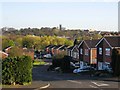
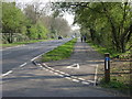
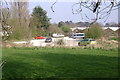
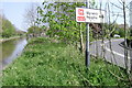
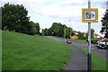
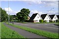

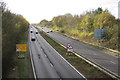
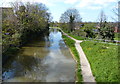

100 photos from this area
Area Information
Key information about the CV34 5UB including its size, population, and administrative classification.
- Area Type
- Postcode
- Area Size
- 9493 m²
- Population
- 1330
- Population Density
- 1884 people/km²
House Prices in CV34 5UB
26
Properties
£224,650
Average Sold Price
£77,000
Lowest Price
£330,000
Highest Price
Showing 26 properties
| Address | Type | Beds | Baths | Last Sale Price | Last Sale Date | |
|---|---|---|---|---|---|---|
| 11 Lowes Avenue, Woodloes Park, Warwick, CV34 5UB | Semi-detached | 2 | 1 | £294,000 | Jun 2024 | |
| 17 Lowes Avenue, Woodloes Park, Warwick, CV34 5UB | Semi-detached | 2 | 1 | £310,000 | Feb 2024 | |
| 23 Lowes Avenue, Woodloes Park, Warwick, CV34 5UB | Semi-detached | 2 | 1 | £286,000 | Dec 2023 | |
| 3 Lowes Avenue, Woodloes Park, Warwick, CV34 5UB | Retail | 2 | 1 | £255,000 | Feb 2023 | |
| 10 Lowes Avenue, Woodloes Park, Warwick, CV34 5UB | Bungalow | - | - | £330,000 | Aug 2022 | |
| 16 Lowes Avenue, Woodloes Park, Warwick, CV34 5UB | Bungalow | - | - | £240,000 | May 2021 | |
| 12 Lowes Avenue, Woodloes Park, Warwick, CV34 5UB | Bungalow | - | - | £281,000 | Oct 2020 | |
| 31 Lowes Avenue, Woodloes Park, Warwick, CV34 5UB | Detached | 3 | 1 | £285,000 | Aug 2020 | |
| 29 Lowes Avenue, Woodloes Park, Warwick, CV34 5UB | Bungalow | 2 | 1 | £220,000 | Mar 2019 | |
| 21 Lowes Avenue, Woodloes Park, Warwick, CV34 5UB | Semi-detached | 2 | 1 | £250,000 | Jun 2018 |
Page 1 of 3
Energy Efficiency in CV34 5UB
Amenities
Schools
| Rank | School | Type | Entry gender | Ages |
|---|
Explore more schools in this area
Go to Schools tabDemographics
Household Size
Two person
most common
Accommodation Type
Houses
most common
Tenure
90
majority
Ethnic Group
White
most common
Religion
N/A
most common
Household Composition
N/A
most common
Age
47
median
Adults (30-64 years)
most common
Household Deprivation
N/A
with no deprivation
NS-SEC
41
in Lower managerial occupations
Explore more demographic insights in this area
Go to Demographics tabPlanning
Planning Constraints
- Flood RiskPremium
- Ramsar Wetland SitesPremium
- Area of Outstanding Natural BeautyPremium
- Protected Nature ReservePremium
- Protected WoodlandPremium