Area Overview for CV34 5TU
Photos of CV34 5TU
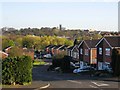
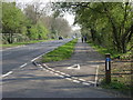
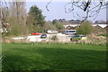
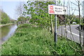
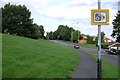
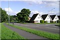


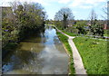
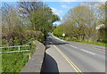
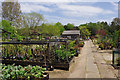
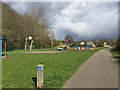
100 photos from this area
Area Information
Key information about the CV34 5TU including its size, population, and administrative classification.
- Area Type
- Postcode
- Area Size
- 7282 m²
- Population
- 1328
- Population Density
- 3494 people/km²
House Prices in CV34 5TU
22
Properties
£196,419
Average Sold Price
£67,000
Lowest Price
£380,000
Highest Price
Showing 22 properties
| Address | Type | Beds | Baths | Last Sale Price | Last Sale Date | |
|---|---|---|---|---|---|---|
| 5 Neville Grove, Woodloes Park, Warwick, CV34 5TU | Detached | 3 | 1 | £375,000 | Jun 2025 | |
| 18 Neville Grove, Woodloes Park, Warwick, CV34 5TU | Semi-detached | 2 | 1 | £200,000 | Dec 2023 | |
| 7 Neville Grove, Woodloes Park, Warwick, CV34 5TU | Semi-detached | 3 | 1 | £380,000 | Nov 2023 | |
| 28 Neville Grove, Woodloes Park, Warwick, CV34 5TU | Semi-detached | 2 | 1 | £195,000 | Jul 2023 | |
| 15 Neville Grove, Woodloes Park, Warwick, CV34 5TU | house | - | - | £305,000 | Oct 2020 | |
| 22 Neville Grove, Woodloes Park, Warwick, CV34 5TU | Bungalow | 2 | 1 | £175,000 | Feb 2018 | |
| 4 Neville Grove, Woodloes Park, Warwick, CV34 5TU | Bungalow | - | - | £167,000 | Dec 2014 | |
| 9 Neville Grove, Woodloes Park, Warwick, CV34 5TU | house | - | - | £220,000 | Dec 2011 | |
| 2 Neville Grove, Woodloes Park, Warwick, CV34 5TU | Bungalow | - | - | £160,000 | Jan 2007 | |
| 30 Neville Grove, Woodloes Park, Warwick, CV34 5TU | Bungalow | 2 | - | £159,500 | Apr 2005 |
Page 1 of 3
Energy Efficiency in CV34 5TU
Amenities
Schools
| Rank | School | Type | Entry gender | Ages |
|---|
Explore more schools in this area
Go to Schools tabDemographics
Household Size
Two person
most common
Accommodation Type
Houses
most common
Tenure
81
majority
Ethnic Group
White
most common
Religion
N/A
most common
Household Composition
N/A
most common
Age
47
median
Adults (30-64 years)
most common
Household Deprivation
N/A
with no deprivation
NS-SEC
45
in Lower managerial occupations
Explore more demographic insights in this area
Go to Demographics tabPlanning
Planning Constraints
- Flood RiskPremium
- Ramsar Wetland SitesPremium
- Area of Outstanding Natural BeautyPremium
- Protected Nature ReservePremium
- Protected WoodlandPremium