Area Overview for CV34 5LQ
Photos of CV34 5LQ
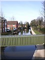
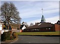
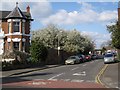
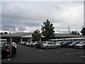

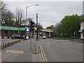
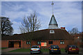

100 photos from this area
Area Information
Key information about the CV34 5LQ including its size, population, and administrative classification.
- Area Type
- Postcode
- Area Size
- 1.7 hectares
- Population
- 1372
- Population Density
- 3193 people/km²
House Prices in CV34 5LQ
39
Properties
£312,218
Average Sold Price
£112,000
Lowest Price
£620,000
Highest Price
Showing 39 properties
| Address | Type | Beds | Baths | Last Sale Price | Last Sale Date | |
|---|---|---|---|---|---|---|
| 37 Charles Street, Warwick, CV34 5LQ | Semi-detached | 3 | 1 | £376,500 | Jun 2025 | |
| 54 Charles Street, Warwick, CV34 5LQ | Semi-detached | 3 | 1 | £415,000 | Apr 2024 | |
| 61 Charles Street, Warwick, CV34 5LQ | Detached | 3 | 1 | £405,000 | May 2022 | |
| 42 Charles Street, Warwick, CV34 5LQ | house | - | - | £620,000 | Feb 2022 | |
| 27 Charles Street, Warwick, CV34 5LQ | Semi-detached | 3 | - | £381,128 | Sep 2021 | |
| 33 Charles Street, Warwick, CV34 5LQ | Semi-detached | 3 | 1 | £305,000 | May 2021 | |
| 46 Charles Street, Warwick, CV34 5LQ | house | - | - | £387,750 | Mar 2020 | |
| 34 Charles Street, Warwick, CV34 5LQ | house | - | - | £480,000 | Jul 2019 | |
| 71 Charles Street, Warwick, CV34 5LQ | Semi-detached | 4 | 1 | £475,000 | Nov 2018 | |
| 44 Charles Street, Warwick, CV34 5LQ | Semi-detached | 4 | - | £520,000 | Apr 2018 |
Page 1 of 4
Energy Efficiency in CV34 5LQ
Amenities
Schools
| Rank | School | Type | Entry gender | Ages |
|---|
Explore more schools in this area
Go to Schools tabDemographics
Household Size
One person
most common
Accommodation Type
Houses
most common
Tenure
60
majority
Ethnic Group
White
most common
Religion
N/A
most common
Household Composition
N/A
most common
Age
47
median
Adults (30-64 years)
most common
Household Deprivation
N/A
with no deprivation
NS-SEC
32
in Lower managerial occupations
Explore more demographic insights in this area
Go to Demographics tabPlanning
Planning Constraints
- Flood RiskPremium
- Ramsar Wetland SitesPremium
- Area of Outstanding Natural BeautyPremium
- Protected Nature ReservePremium
- Protected WoodlandPremium