Area Overview for CV34 5HP
Photos of CV34 5HP
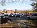


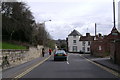
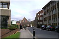
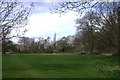
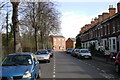


100 photos from this area
Area Information
Key information about the CV34 5HP including its size, population, and administrative classification.
- Area Type
- Postcode
- Area Size
- 1.0 hectares
- Population
- 1981
- Population Density
- 4610 people/km²
House Prices in CV34 5HP
34
Properties
£207,782
Average Sold Price
£57,000
Lowest Price
£455,000
Highest Price
Showing 34 properties
| Address | Type | Beds | Baths | Last Sale Price | Last Sale Date | |
|---|---|---|---|---|---|---|
| 48 Fields Court, Warwick, CV34 5HP | Detached | 3 | 1 | £272,000 | Nov 2025 | |
| 54 Fields Court, Warwick, CV34 5HP | Bungalow | 4 | 2 | £455,000 | May 2025 | |
| 70 Fields Court, Warwick, CV34 5HP | Bungalow | 3 | 1 | £335,000 | Jun 2024 | |
| 30 Fields Court, Warwick, CV34 5HP | house | 3 | - | £322,000 | May 2023 | |
| 36 Fields Court, Warwick, CV34 5HP | Retail | 3 | 2 | £330,000 | May 2022 | |
| 28 Fields Court, Warwick, CV34 5HP | house | - | - | £225,000 | May 2022 | |
| 56 Fields Court, Warwick, CV34 5HP | Bungalow | - | - | £282,500 | Jul 2021 | |
| 12 Fields Court, Warwick, CV34 5HP | house | - | - | £230,000 | Aug 2020 | |
| 22A Fields Court, Warwick, CV34 5HP | Flat | - | - | £176,000 | Jul 2020 | |
| 46 Fields Court, Warwick, CV34 5HP | house | 3 | 1 | £245,000 | Sep 2018 |
Page 1 of 4
Energy Efficiency in CV34 5HP
Amenities
Schools
| Rank | School | Type | Entry gender | Ages |
|---|
Explore more schools in this area
Go to Schools tabDemographics
Household Size
One person
most common
Accommodation Type
Houses
most common
Tenure
72
majority
Ethnic Group
White
most common
Religion
N/A
most common
Household Composition
N/A
most common
Age
47
median
Adults (30-64 years)
most common
Household Deprivation
N/A
with no deprivation
NS-SEC
51
in Lower managerial occupations
Explore more demographic insights in this area
Go to Demographics tabPlanning
Planning Constraints
- Flood RiskPremium
- Ramsar Wetland SitesPremium
- Area of Outstanding Natural BeautyPremium
- Protected Nature ReservePremium
- Protected WoodlandPremium