Area Overview for CV34 5EU
Photos of CV34 5EU


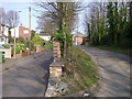

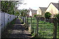
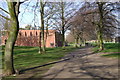
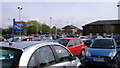
100 photos from this area
Area Information
Key information about the CV34 5EU including its size, population, and administrative classification.
- Area Type
- Postcode
- Area Size
- 1.3 hectares
- Population
- 1297
- Population Density
- 5500 people/km²
House Prices in CV34 5EU
35
Properties
£158,693
Average Sold Price
£45,500
Lowest Price
£310,000
Highest Price
Showing 35 properties
| Address | Type | Beds | Baths | Last Sale Price | Last Sale Date | |
|---|---|---|---|---|---|---|
| 9 Percy Road, Warwick, CV34 5EU | Semi-detached | 3 | 1 | £310,000 | Oct 2022 | |
| 21 Percy Road, Warwick, CV34 5EU | house | - | - | £260,000 | Jun 2022 | |
| 28 Percy Road, Warwick, CV34 5EU | house | 3 | 1 | £242,000 | Aug 2018 | |
| 25 Percy Road, Warwick, CV34 5EU | Terraced | 3 | 1 | £225,000 | Aug 2018 | |
| 10 Percy Road, Warwick, CV34 5EU | Detached | 3 | 1 | £241,000 | Jun 2017 | |
| 4 Percy Road, Warwick, CV34 5EU | Terraced | 3 | 1 | £162,000 | Sep 2015 | |
| 8 Percy Road, Warwick, CV34 5EU | Terraced | 3 | 1 | £157,500 | Nov 2013 | |
| 33 Percy Road, Warwick, CV34 5EU | Flat | - | - | £124,995 | Apr 2007 | |
| 35 Percy Road, Warwick, CV34 5EU | Terraced | 3 | 1 | £142,000 | Jun 2005 | |
| 17 Percy Road, Warwick, CV34 5EU | Terraced | - | - | £134,950 | Jun 2004 |
Page 1 of 4
Energy Efficiency in CV34 5EU
Amenities
Schools
| Rank | School | Type | Entry gender | Ages |
|---|
Explore more schools in this area
Go to Schools tabDemographics
Household Size
Family (3-5 people)
most common
Accommodation Type
Houses
most common
Tenure
40
majority
Ethnic Group
White
most common
Religion
N/A
most common
Household Composition
N/A
most common
Age
47
median
Adults (30-64 years)
most common
Household Deprivation
N/A
with no deprivation
NS-SEC
26
in Lower managerial occupations
Explore more demographic insights in this area
Go to Demographics tabPlanning
Planning Constraints
- Flood RiskPremium
- Ramsar Wetland SitesPremium
- Area of Outstanding Natural BeautyPremium
- Protected Nature ReservePremium
- Protected WoodlandPremium