Area Overview for CV34 4JD
Photos of CV34 4JD


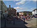

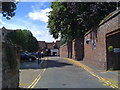
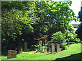

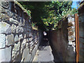

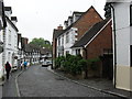


100 photos from this area
Area Information
Key information about the CV34 4JD including its size, population, and administrative classification.
- Area Type
- Postcode
- Area Size
- 2.7 hectares
- Population
- 1545
- Population Density
- 581 people/km²
House Prices in CV34 4JD
78
Properties
£295,436
Average Sold Price
£35,000
Lowest Price
£970,000
Highest Price
Showing 78 properties
| Address | Type | Beds | Baths | Last Sale Price | Last Sale Date | |
|---|---|---|---|---|---|---|
| 62 St Nicholas Church Street, Warwick, CV34 4JD | Semi-detached | 3 | 2 | £410,000 | May 2024 | |
| 4, The Corn Barn, St Nicholas Church Street, Warwick, CV34 4JD | Flat | - | - | £175,000 | Apr 2024 | |
| 11 St Nicholas Church Street, Warwick, CV34 4JD | house | 2 | 1 | £310,000 | Dec 2023 | |
| 24 St Nicholas Church Street, Warwick, CV34 4JD | Terraced | 3 | 1 | £480,000 | Oct 2023 | |
| 42 St Nicholas Church Street, Warwick, CV34 4JD | house | 3 | 3 | £475,000 | Feb 2023 | |
| 46 St Nicholas Church Street, Warwick, CV34 4JD | Flat | 1 | 1 | £310,000 | Mar 2022 | |
| 28 St Nicholas Church Street, Warwick, CV34 4JD | Retail | 4 | 1 | £345,000 | Dec 2021 | |
| 7, Avery Court, St Nicholas Church Street, Warwick, CV34 4JD | Flat | 1 | - | £145,000 | Dec 2021 | |
| 5, Fairfax Court, St Nicholas Church Street, Warwick, CV34 4JD | Flat | 2 | - | £240,000 | Jul 2021 | |
| 54 St Nicholas Church Street, Warwick, CV34 4JD | Flat | 3 | 2 | £375,000 | Oct 2020 |
Page 1 of 8
Energy Efficiency in CV34 4JD
Amenities
Schools
| Rank | School | Type | Entry gender | Ages |
|---|
Explore more schools in this area
Go to Schools tabDemographics
Household Size
Two person
most common
Accommodation Type
Houses
most common
Tenure
78
majority
Ethnic Group
White
most common
Religion
N/A
most common
Household Composition
N/A
most common
Age
47
median
Adults (30-64 years)
most common
Household Deprivation
N/A
with no deprivation
NS-SEC
52
in Lower managerial occupations
Explore more demographic insights in this area
Go to Demographics tabPlanning
Planning Constraints
- Flood RiskPremium
- Ramsar Wetland SitesPremium
- Area of Outstanding Natural BeautyPremium
- Protected Nature ReservePremium
- Protected WoodlandPremium