Area Overview for CV34 4BB
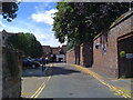
Photos of CV34 4BB

Area Information
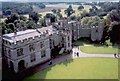
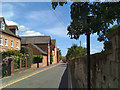
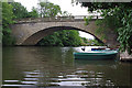
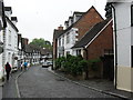
CV34 4BB is a small residential cluster in Warwickshire, England, nestled within the historic town of Warwick. With a population of 1,545 spread across 808 square metres, the area has a population density of 581 people per square kilometre, reflecting a compact, closely-knit community. Warwick itself is a town of strategic significance, situated on the River Avon and historically pivotal for trade and defence. The area benefits from proximity to key landmarks like Warwick Castle, a medieval fortress that has shaped the town’s identity for centuries. Daily life here blends historical charm with modern convenience, with residents enjoying access to nearby amenities and transport links. The area’s small size means it is likely to feel more intimate than larger urban centres, with a focus on local connections and community cohesion. Warwick’s location also offers easy access to surrounding towns like Stratford-upon-Avon and Coventry, providing a balance between rural tranquillity and regional connectivity. For those considering living in CV34 4BB, the mix of heritage and practicality makes it an appealing choice for families and professionals alike.
- Area Type
- Postcode
- Area Size
- 808 m²
- Population
- 1545
- Population Density
- 581 people/km²
The property market in CV34 4BB is shaped by its small size and high population density, suggesting a limited but focused housing stock. While specific data on home ownership rates or accommodation types is not provided, the area’s compact nature implies a predominance of smaller properties, such as terraced houses or flats, catering to families and individuals. The absence of detailed market figures means it is unclear whether the area is primarily owner-occupied or rental-focused. However, the proximity to schools, retail, and transport hubs could make it attractive to buyers seeking a balance between affordability and accessibility. Given the area’s size, property prices may be influenced by local demand and the historical significance of nearby landmarks like Warwick Castle. Buyers should consider the limited land availability and the potential for competition in a small, desirable postcode.
House Prices in CV34 4BB
Showing 1 properties
| Address | Type | Beds | Baths | Last Sale Price | Last Sale Date | |
|---|---|---|---|---|---|---|
| Godfrey-payton, 25 High Street, Warwick, CV34 4BB | office_workshop | - | - | - | - |
Energy Efficiency in CV34 4BB
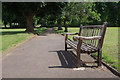
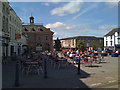
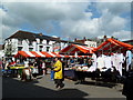
Daily life in CV34 4BB is enriched by nearby amenities, including five retail outlets such as Sainsburys Warwick and Asda Stratrode, ensuring convenient access to shopping and essentials. The area’s rail links, with stations like Warwick Parkway and Leamington Spa, provide easy access to surrounding towns and cities. The proximity to Wellesbourne Mountford Airport adds to the area’s connectivity, though it is not a major international hub. For leisure, the historic Warwick Castle and River Avon offer cultural and scenic opportunities. The compact nature of the area means amenities are within walking or short driving distance, fostering a sense of convenience. While specific parks or recreational spaces are not listed, the town’s historical infrastructure, such as Castle Bridge, suggests a blend of heritage and functional design. The mix of retail, transport, and cultural assets supports a lifestyle that balances practicality with local charm.
Amenities
Schools
The area is served by three independent schools: Warwick Preparatory School, Warwick School, and King’s High School. These institutions cater to a range of educational needs, from primary to secondary levels, and are likely to attract families prioritising private education. The presence of multiple independent schools suggests a strong emphasis on academic provision, though no Ofsted ratings are provided in the data. The mix of school types may indicate a community that values choice in education, with options for both younger and older students. However, the absence of state schools in the list means families relying on public education may need to look further afield. The proximity of these schools to CV34 4BB underscores the area’s appeal to households seeking quality schooling within a short commute.
| Rank | School | Type | Entry gender | Ages |
|---|
Explore more schools in this area
Go to Schools tabDemographics
The area’s population of 1,545 is concentrated within a small footprint, resulting in a high density of 581 people per square kilometre. While specific data on age distribution or household composition is not available, the compact nature of the area suggests a mix of family homes and smaller dwellings. The absence of detailed demographic statistics means broader conclusions about the community’s structure or diversity cannot be drawn. However, the presence of independent schools and nearby amenities indicates the area may attract professionals and families seeking a blend of education and convenience. The lack of specific deprivation data also means it is unclear how economic factors might influence quality of life. Residents likely benefit from the area’s proximity to services and transport, though the high density could imply a need for efficient local infrastructure to meet demand.
Household Size
Accommodation Type
Tenure
Ethnic Group
Religion
Household Composition
Age
Household Deprivation
NS-SEC
Explore more demographic insights in this area
Go to Demographics tabPlanning
Planning Constraints
- Flood RiskPremium
- Ramsar Wetland SitesPremium
- Area of Outstanding Natural BeautyPremium
- Protected Nature ReservePremium
- Protected WoodlandPremium