Area Overview for CV33 9UG
Photos of CV33 9UG
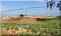
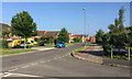
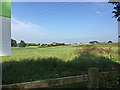

30 photos from this area
Area Information
Key information about the CV33 9UG including its size, population, and administrative classification.
- Area Type
- Postcode
- Area Size
- 1.2 hectares
- Population
- 2902
- Population Density
- 1548 people/km²
House Prices in CV33 9UG
32
Properties
£347,906
Average Sold Price
£245,000
Lowest Price
£495,000
Highest Price
Showing 32 properties
| Address | Type | Beds | Baths | Last Sale Price | Last Sale Date | |
|---|---|---|---|---|---|---|
| 10 Royal Boulevard, Bishops Tachbrook, CV33 9UG | Terraced | 2 | 1 | £288,088 | Mar 2025 | |
| 16 Royal Boulevard, Bishops Tachbrook, CV33 9UG | Terraced | 2 | 2 | £245,000 | May 2021 | |
| 33 Royal Boulevard, Bishops Tachbrook, CV33 9UG | house | - | - | £300,000 | Dec 2020 | |
| 9 Royal Boulevard, Bishops Tachbrook, CV33 9UG | Terraced | 2 | 2 | £255,500 | Jun 2019 | |
| 5 Royal Boulevard, Bishops Tachbrook, CV33 9UG | house | - | - | £490,000 | May 2018 | |
| 4 Royal Boulevard, Bishops Tachbrook, CV33 9UG | house | - | - | £460,000 | May 2018 | |
| 6 Royal Boulevard, Bishops Tachbrook, CV33 9UG | house | - | - | £495,000 | Mar 2018 | |
| 7 Royal Boulevard, Bishops Tachbrook, CV33 9UG | house | - | - | £450,000 | Mar 2018 | |
| 32 Royal Boulevard, Bishops Tachbrook, CV33 9UG | Detached | 3 | 1 | £375,000 | Mar 2018 | |
| 17 Royal Boulevard, Bishops Tachbrook, CV33 9UG | house | - | - | £255,000 | Jan 2018 |
Page 1 of 4
Energy Efficiency in CV33 9UG
Amenities
Schools
| Rank | School | Type | Entry gender | Ages |
|---|
Explore more schools in this area
Go to Schools tabDemographics
Household Size
Family (3-5 people)
most common
Accommodation Type
Houses
most common
Tenure
77
majority
Ethnic Group
White
most common
Religion
N/A
most common
Household Composition
N/A
most common
Age
47
median
Adults (30-64 years)
most common
Household Deprivation
N/A
with no deprivation
NS-SEC
53
in Lower managerial occupations
Explore more demographic insights in this area
Go to Demographics tabPlanning
Planning Constraints
- Flood RiskPremium
- Ramsar Wetland SitesPremium
- Area of Outstanding Natural BeautyPremium
- Protected Nature ReservePremium
- Protected WoodlandPremium