Area Overview for CV33 9TE
Photos of CV33 9TE
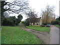
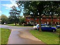
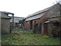
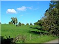

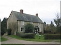
11 photos from this area
Area Information
Key information about the CV33 9TE including its size, population, and administrative classification.
- Area Type
- Postcode
- Area Size
- 5.5 hectares
- Population
- 1424
- Population Density
- 167 people/km²
House Prices in CV33 9TE
31
Properties
£159,540
Average Sold Price
£117,950
Lowest Price
£245,000
Highest Price
Showing 31 properties
| Address | Type | Beds | Baths | Last Sale Price | Last Sale Date | |
|---|---|---|---|---|---|---|
| 18 Leam Road, Lighthorne Heath, Lighthorne, CV33 9TE | house | 4 | 2 | £225,000 | Jun 2021 | |
| Shoehorn House, Leam Road, Lighthorne Heath, Lighthorne, CV33 9TE | house | - | - | £245,000 | Apr 2021 | |
| 6 Leam Road, Lighthorne Heath, Lighthorne, CV33 9TE | Terraced | 2 | 1 | £128,500 | Mar 2016 | |
| Lane End, Leam Road, Lighthorne Heath, Lighthorne, CV33 9TE | Terraced | 3 | 1 | £179,000 | Feb 2016 | |
| Helsten, Leam Road, Lighthorne Heath, Lighthorne, CV33 9TE | house | - | - | £142,000 | Jan 2007 | |
| 22 Leam Road, Lighthorne Heath, Lighthorne, CV33 9TE | house | - | - | £180,000 | May 2004 | |
| Round N Round, Leam Road, Lighthorne Heath, Lighthorne, CV33 9TE | house | - | - | £117,950 | May 2003 | |
| 21 Leam Road, Lighthorne Heath, Lighthorne, CV33 9TE | house | - | - | £118,000 | Dec 2002 | |
| 20 Leam Road, Lighthorne Heath, Lighthorne, CV33 9TE | Terraced | - | - | £134,950 | Nov 2002 | |
| Hazell House, Leam Road, Lighthorne Heath, Lighthorne, CV33 9TE | Detached | - | - | £125,000 | Dec 2000 |
Page 1 of 4
Energy Efficiency in CV33 9TE
Amenities
Schools
| Rank | School | Type | Entry gender | Ages |
|---|
Explore more schools in this area
Go to Schools tabDemographics
Household Size
Two person
most common
Accommodation Type
Houses
most common
Tenure
73
majority
Ethnic Group
White
most common
Religion
N/A
most common
Household Composition
N/A
most common
Age
47
median
Adults (30-64 years)
most common
Household Deprivation
N/A
with no deprivation
NS-SEC
40
in Lower managerial occupations
Explore more demographic insights in this area
Go to Demographics tabPlanning
Planning Constraints
- Flood RiskPremium
- Ramsar Wetland SitesPremium
- Area of Outstanding Natural BeautyPremium
- Protected Nature ReservePremium
- Protected WoodlandPremium