Area Overview for CV32 7DW
Photos of CV32 7DW


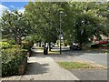
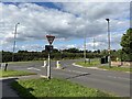
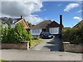
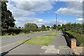
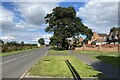
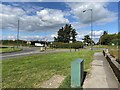
35 photos from this area
Area Information
Key information about the CV32 7DW including its size, population, and administrative classification.
- Area Type
- Postcode
- Area Size
- 1.3 hectares
- Population
- 1521
- Population Density
- 4280 people/km²
House Prices in CV32 7DW
25
Properties
£232,654
Average Sold Price
£59,000
Lowest Price
£540,000
Highest Price
Showing 25 properties
| Address | Type | Beds | Baths | Last Sale Price | Last Sale Date | |
|---|---|---|---|---|---|---|
| 8 Helmsdale Road, Lillington, Leamington Spa, CV32 7DW | house | 3 | 1 | £486,000 | Jun 2025 | |
| 28 Helmsdale Road, Lillington, Leamington Spa, CV32 7DW | house | - | - | £503,000 | Aug 2023 | |
| 40 Helmsdale Road, Lillington, Leamington Spa, CV32 7DW | Semi-detached | 3 | 1 | £540,000 | Jan 2023 | |
| 32 Helmsdale Road, Lillington, Leamington Spa, CV32 7DW | Semi-detached | 3 | 1 | £230,500 | May 2012 | |
| 12 Helmsdale Road, Lillington, Leamington Spa, CV32 7DW | house | 4 | - | £299,950 | Aug 2010 | |
| 30 Helmsdale Road, Lillington, Leamington Spa, CV32 7DW | house | - | - | £236,000 | Sep 2009 | |
| 10 Helmsdale Road, Lillington, Leamington Spa, CV32 7DW | Semi-detached | - | - | £173,000 | Nov 2008 | |
| 42 Helmsdale Road, Lillington, Leamington Spa, CV32 7DW | Semi-detached | - | - | £169,950 | May 2001 | |
| 34 Helmsdale Road, Lillington, Leamington Spa, CV32 7DW | Semi-detached | 3 | 1 | £107,500 | Oct 2000 | |
| 50 Helmsdale Road, Lillington, Leamington Spa, CV32 7DW | Detached | 5 | 3 | £115,000 | Feb 2000 |
Page 1 of 3
Energy Efficiency in CV32 7DW
Amenities
Schools
| Rank | School | Type | Entry gender | Ages |
|---|
Explore more schools in this area
Go to Schools tabDemographics
Household Size
Family (3-5 people)
most common
Accommodation Type
Houses
most common
Tenure
90
majority
Ethnic Group
White
most common
Religion
N/A
most common
Household Composition
N/A
most common
Age
47
median
Adults (30-64 years)
most common
Household Deprivation
N/A
with no deprivation
NS-SEC
51
in Lower managerial occupations
Explore more demographic insights in this area
Go to Demographics tabPlanning
Planning Constraints
- Flood RiskPremium
- Ramsar Wetland SitesPremium
- Area of Outstanding Natural BeautyPremium
- Protected Nature ReservePremium
- Protected WoodlandPremium