Area Overview for CV32 7AL
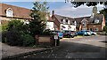
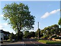
Photos of CV32 7AL


Area Information
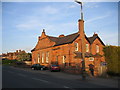
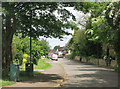
CV32 7AL represents a specific postcode cluster within the broader context of Royal Leamington Spa, a historic spa town in Warwickshire. This residential area covers 4,356 square metres and supports a population of 1,599 people. The location sits at coordinates 52.286498, -1.532773, placing it in close proximity to the town's established centre and its renowned mineral springs. Originally known as Leamington Priors under Kenilworth Priory control, the area has evolved into a fashionable resort defined by its 18th-century discovery of medicinal springs. The geography here is tight and focused, creating a dense residential environment typical of settled towns rather than sprawling suburbs. Residents benefit from a setting rich in historical significance, from the founding of the world's first tennis club to the opening of the Royal Pump Room in 1814. Daily life in CV32 7AL revolves around a neighbourhood that balances its Victorian heritage with modern convenience. You will live in a community where the past remains visible in landmarks like Jephson Gardens and the Regent Hotel, yet everyday needs are met by established retail and transport links. The area offers a quiet existence without isolation, allowing you to walk to essential services while staying connected to the wider region. Buying a home here means joining a community with deep roots and a distinct character shaped by centuries of evolution.
- Area Type
- Postcode
- Area Size
- 4356 m²
- Population
- 1599
- Population Density
- 5465 people/km²
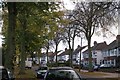
The property market in CV32 7AL is characterised by an overwhelmingly owner-occupied landscape. With 88% of households owning their homes, the area functions primarily as a community for existing residents rather than a hub for short-term tenancies. The accommodation type data confirms that houses dominate the housing stock, meaning you will find terraced, semi-detached, and detached properties rather than the flat buildings common in high-density city centres. This housing mix suits those seeking privacy and traditional garden access. Buyers looking at this specific postcode should expect a market where established owners are rare to come across. Instead, you might find sales from people retiring to the area or individuals who have upgraded after many years. The small physical size of the area, covering only 4,356 square metres, further concentrates these homes, creating a tangible sense of place. When searching for homes in CV32 7AL, you are not in a speculative development zone but within a mature settlement. The high ownership rate often correlates with better-maintained property standards, as owners tend to invest more in upkeep than tenants. This balance of stability and traditional housing types makes the area attractive for buyers valuing permanence over flexibility. The market here is defined by these practical realities: long-term occupancy and house-based living arrangements.
House Prices in CV32 7AL
Showing 8 properties
| Address | Type | Beds | Baths | Last Sale Price | Last Sale Date | |
|---|---|---|---|---|---|---|
| 91 Cubbington Road, Lillington, Leamington Spa, CV32 7AL | Terraced | 3 | 1 | £225,000 | Nov 2019 | |
| 99 Cubbington Road, Lillington, Leamington Spa, CV32 7AL | house | - | - | - | - | |
| 95 Cubbington Road, Lillington, Leamington Spa, CV32 7AL | Terraced | - | - | - | - | |
| 101 Cubbington Road, Lillington, Leamington Spa, CV32 7AL | house | - | - | - | - | |
| 89 Cubbington Road, Lillington, Leamington Spa, CV32 7AL | house | - | - | - | - | |
| 97 Cubbington Road, Lillington, Leamington Spa, CV32 7AL | house | - | - | - | - | |
| 103 Cubbington Road, Lillington, Leamington Spa, CV32 7AL | house | - | - | - | - | |
| 93 Cubbington Road, Lillington, Leamington Spa, CV32 7AL | Terraced | - | - | - | - |
Energy Efficiency in CV32 7AL
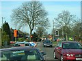
Living in CV32 7AL places you within easy reach of substantial retail and transport hubs. Five major retail locations operate within practical commuting distance, including Tesco Lillington, Spar, and Sainsburys Cubbington. These supermarkets and convenience stores ensure you can access fresh food, household essentials, and daily necessities without needing to travel far. Four railway stations lie nearby, offering swift connections to Leamington Spa Railway Station, Warwick Railway Station, and Kenilworth Railway Station. These links integrate you into the wider transport network, allowing quick access to both local amenities and major regional cities. Coventry Airport, listed twice in the nearest facilities, provides regional travel options for business or leisure. Your daily life benefits from this dense array of services located just beyond the immediate boundary of your postcode. You can combine a quiet residential street with the convenience of immediate access to shopping centres and train lines. The presence of three distinct supermarket chains means competitive pricing and variety are always available. Dining and leisure options in Royal Leamington Spa complement these commercial hubs, round out your week with cultural events and restaurants. This blend of local independence and broader access defines the practical rhythm of life here.
Amenities
Schools
| Rank | School | Type | Entry gender | Ages |
|---|
Explore more schools in this area
Go to Schools tabDemographics
The community of CV32 7AL reflects a settled, mature demographic profile. The median age for residents stands at 47 years, with adults between 30 and 64 years comprising the most common age range. This indicates a population that has likely grown up within the locality or moved there later in life seeking stability. Home ownership is the dominant household model, with 88% of properties owned outright or with a mortgage. Very few people rent in this postcode, suggesting long-term residency and investment in the local property stock. The primary accommodation type consists of houses, creating an environment suited to families or individuals preferring ground floor or semi-detached living arrangements over shared flats. White residents form the predominant ethnic group, aligning with the traditional character of many Warwickshire towns. The high ownership rate contrasts sharply with newer urban developments where rental proportions often exceed 50%. This snapshot confirms a stable, owner-occupied neighbourhood. You are unlikely to encounter transient populations here. Instead, you will engage with neighbours who have often lived in their homes for decades, fostering strong local ties. The age profile suggests a quieter evening atmosphere during weekdays, with retirees and working families sharing the streets. This demographic stability contributes to a predictable and low-conflict living environment for new arrivals.
Household Size
Accommodation Type
Tenure
Ethnic Group
Religion
Household Composition
Age
Household Deprivation
NS-SEC
Explore more demographic insights in this area
Go to Demographics tabPlanning
Planning Constraints
- Flood RiskPremium
- Ramsar Wetland SitesPremium
- Area of Outstanding Natural BeautyPremium
- Protected Nature ReservePremium
- Protected WoodlandPremium