Area Overview for CV32 6RN
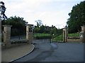
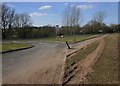
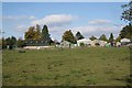
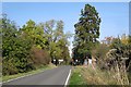
Photos of CV32 6RN


Area Information
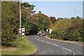
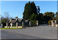
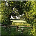
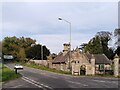
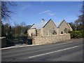
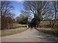
CV32 6RN is a small, tightly knit residential postcode area in Warwickshire, encompassing parts of Old Milverton, a historic hamlet near the River Avon. With a population of 1,737 spread over 7.1 hectares, it is a compact community where rural charm meets suburban convenience. The area’s character is shaped by its proximity to Leamington Spa and Warwick, offering a balance of quiet living and easy access to nearby towns. Historically, Old Milverton was a medieval parish, with remnants like the Church of St James, rebuilt in the 19th century, and earthworks from a post-medieval settlement at Lower Green. Today, residents benefit from a mix of traditional and modern amenities, including nearby rail links and retail outlets. The area’s small size means a close-knit community feel, with a population skewed toward adults aged 30–64, reflecting a stable, established demographic. Living here offers a blend of historical interest and practicality, with a low crime rate and good digital connectivity, though flood risk remains a consideration for prospective buyers.
- Area Type
- Postcode
- Area Size
- 7.1 hectares
- Population
- 1737
- Population Density
- 204 people/km²
CV32 6RN is predominantly an owner-occupied area, with 85% of homes owned by residents rather than rented. The accommodation type is exclusively houses, which is uncommon in smaller postcode areas and suggests a focus on family homes or detached properties. This composition likely limits the availability of flats or rental properties, making the market more competitive for buyers seeking owner-occupied housing. The small area size—just 7.1 hectares—means the housing stock is limited, potentially increasing demand from nearby regions. For buyers, this implies a need to act swiftly, as properties may not remain on the market for long. The absence of rental properties also means the area is less attractive to investors seeking yield, though it could appeal to those prioritising long-term stability. The focus on houses may also reflect the area’s semi-rural character, offering more space than urban centres.
House Prices in CV32 6RN
No properties found in this postcode.
Energy Efficiency in CV32 6RN
The lifestyle in CV32 6RN is shaped by its proximity to retail, transport, and historical sites. Nearby shops include Tesco Lillington, Spar, and Sainsburys Cubbington, providing essential groceries and services. Rail stations like Leamington Spa and Warwick offer easy access to urban centres, while Coventry Airport provides regional air travel options. The area’s historical allure includes the Church of St James, Guy’s Cliffe House ruins, and the Saxon Mill pub, which adds cultural depth to daily life. The River Avon’s presence, though not explicitly detailed in amenities, likely contributes to recreational opportunities. The mix of retail, transport, and heritage sites creates a convenient yet characterful environment, blending practicality with historical interest. However, the absence of parks or leisure facilities in the data means outdoor recreation may require travel to nearby towns.
Amenities
Schools
The nearest schools to CV32 6RN include North Leamington School, which operates both as a primary school and an academy. While no Ofsted ratings are provided, the dual role of the school suggests it serves a range of educational needs, from early years to secondary education. The presence of a primary school within the area is a key factor for families, reducing the need for long commutes. However, the lack of additional schools or specific details on curriculum or facilities means prospective buyers must research further to assess suitability. The mix of school types—primary and academy—could indicate a focus on both foundational education and specialist programs, though the absence of data on performance or capacity leaves gaps in understanding. Families should consider proximity to other schools in nearby towns like Leamington Spa for broader options.
| Rank | School | Type | Entry gender | Ages |
|---|
Explore more schools in this area
Go to Schools tabDemographics
The population of CV32 6RN is 1,737, with a median age of 47, indicating a mature community where most residents are adults aged 30–64. Home ownership is high, at 85%, suggesting a predominantly owner-occupied area with long-term residents. The accommodation type is largely houses, reflecting a suburban or semi-rural layout rather than high-density housing. The predominant ethnic group is White, aligning with broader regional trends. This demographic profile implies a stable, family-oriented environment with fewer transient populations. The age range of 30–64 suggests a mix of working-age individuals and retirees, potentially supporting local services and community activities. However, the lack of data on deprivation or diversity means the area’s socio-economic nuances remain underexplored, though the high home ownership rate and low crime score suggest a relatively secure and self-sufficient community.
Household Size
Accommodation Type
Tenure
Ethnic Group
Religion
Household Composition
Age
Household Deprivation
NS-SEC
Explore more demographic insights in this area
Go to Demographics tabPlanning
Planning Constraints
- Flood RiskPremium
- Ramsar Wetland SitesPremium
- Area of Outstanding Natural BeautyPremium
- Protected Nature ReservePremium
- Protected WoodlandPremium