Area Overview for CV31 2QA
Photos of CV31 2QA


Area Information
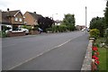
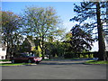
CV31 2QA is a small, tightly knit residential postcode in Warwickshire, forming part of the Whitnash area, which lies between Leamington Spa and Warwick. With a population of 1,828 spread across 4 hectares, this is a densely populated yet compact community. Its historical roots are evident in the surrounding town of Whitnash, which has grown from a small village into a town with a distinct local identity. The area is defined by its proximity to major towns, offering a balance between rural charm and urban accessibility. Daily life here is shaped by the surrounding infrastructure, including nearby railway stations and retail hubs. The population density of 664 people per square kilometre reflects a mix of long-standing residents and those drawn to the area’s practicality and connectivity. While small, CV31 2QA sits at the heart of a region with a rich history, from Iron Age settlements to 19th-century railway developments, creating a community with a layered sense of place.
- Area Type
- Postcode
- Area Size
- 4.0 hectares
- Population
- 1828
- Population Density
- 664 people/km²
The property market in CV31 2QA is characterised by high home ownership (82%) and a predominance of houses. This indicates a community where most residents own their homes, likely reflecting long-term residency and a preference for traditional housing over flats or rental properties. The small area size—just 4 hectares—suggests a limited number of properties, with the surrounding regions of Whitnash and nearby towns offering more extensive options. For buyers, this means competition for existing homes may be fierce, but the focus on owner-occupied properties could mean fewer rental options. The housing stock is likely to include older, characterful homes, given the area’s historical context and the presence of conservation areas nearby. Buyers should consider the limited availability of new builds and the potential need to look beyond CV31 2QA for larger property selections.
House Prices in CV31 2QA
Showing 2 properties
| Address | Type | Beds | Baths | Last Sale Price | Last Sale Date | |
|---|---|---|---|---|---|---|
| Leamington And County Golf Course, Golf Lane, Whitnash, CV31 2QA | Leisure | - | - | - | - | |
| Stewards Accommodation, Leamington And County Golf Course, Golf Lane, Whitnash, CV31 2QA | Detached | - | - | - | - |
Energy Efficiency in CV31 2QA
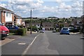
The lifestyle in CV31 2QA is shaped by its proximity to retail and transport hubs. Nearby shops include Heart of England Co-operative Co, Asda Leamington, and East of England Co-operative Co, offering a range of everyday essentials. These retail options are within practical reach, reducing the need for long commutes. The area’s historical character is complemented by its modern amenities, including rail stations that connect to larger towns. While specific parks or leisure facilities are not detailed in the data, the surrounding region of Whitnash includes conservation areas and historic sites like St Margaret’s Church, suggesting opportunities for cultural and recreational activities. The mix of retail, transport, and heritage elements creates a convenient yet rooted community, where daily life balances practicality with a connection to the past.
Amenities
Schools
The nearest school to CV31 2QA is St Joseph’s Catholic Primary School, which holds an Ofsted rating of ‘good’. This school serves the primary education needs of the area, offering a Catholic curriculum within a well-regarded educational framework. Families in the postcode benefit from a single primary school, though secondary education would require travel to nearby towns such as Leamington Spa or Warwick. The absence of secondary schools within the immediate area means parents must factor in commuting time or consider schools further afield. The ‘good’ rating at St Joseph’s suggests a reliable foundation for early education, but the lack of diverse school options—such as state or independent secondary institutions—may be a consideration for families planning long-term in the area.
| Rank | School | Type | Entry gender | Ages |
|---|
Explore more schools in this area
Go to Schools tabDemographics
The population of CV31 2QA is predominantly adults aged 30–64, with a median age of 47. This suggests a mature, stable community with a strong presence of middle-aged residents. Home ownership is high, at 82%, indicating a preference for long-term residency over rental properties. The accommodation is largely composed of houses, reflecting a traditional housing stock rather than apartments or flats. The predominant ethnic group is White, aligning with broader trends in the region. With 1,828 people in a 4-hectare area, the density of 664 people per square kilometre implies a mix of family homes and smaller dwellings. This demographic profile suggests a community focused on stability, with fewer transient residents. The absence of specific data on deprivation or diversity means the area’s social fabric is not fully quantified, but the high home ownership rate and age profile point to a cohesive, middle-income neighbourhood.
Household Size
Accommodation Type
Tenure
Ethnic Group
Religion
Household Composition
Age
Household Deprivation
NS-SEC
Explore more demographic insights in this area
Go to Demographics tabPlanning
Planning Constraints
- Flood RiskPremium
- Ramsar Wetland SitesPremium
- Area of Outstanding Natural BeautyPremium
- Protected Nature ReservePremium
- Protected WoodlandPremium