Area Overview for CV3 6SL
Photos of CV3 6SL


Area Information
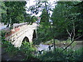
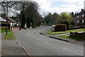
CV3 6SL is a small residential postcode area nestled in the West Midlands, just southwest of Coventry’s city centre. With a population of 1,711, it reflects the character of a suburban ward that has evolved over centuries. Originally developed in the 1850s as a garden village for Coventry’s watchmakers, the area retains echoes of its industrial past, including landmarks like the Earlsdon Clock and historic churches. Today, it is a quiet, family-oriented community with a median age of 47, dominated by adults aged 30–64. The high home ownership rate (94%) suggests a stable, long-term resident base, with most properties being houses rather than flats. Living here means proximity to Coventry’s cultural and economic hubs, yet with the tranquillity of a smaller, more defined neighbourhood. The area’s history as a planned suburb, combined with its modern amenities, offers a blend of heritage and convenience. Residents benefit from nearby retail, transport links, and a low crime score, making it appealing for those seeking a balanced lifestyle with strong community roots.
- Area Type
- Postcode
- Area Size
- Not available
- Population
- 1711
- Population Density
- 5555 people/km²
The property market in CV3 6SL is dominated by owner-occupied homes, with 94% of properties being owned rather than rented. This high level of home ownership indicates a community of long-term residents who have established roots in the area. The accommodation type is primarily houses, which is typical of suburban wards and suggests a preference for larger, more private living spaces. Given the small size of the postcode area, the housing stock is likely limited, meaning buyers may need to consider nearby suburbs for more options. The focus on owner-occupied properties also implies a lower rental market, which could be beneficial for those seeking stability but less so for investors. The predominance of houses, combined with the area’s historical development as a garden village, suggests a mix of traditional and modern properties. Buyers should be aware that the market may be niche, with fewer properties coming to market compared to larger urban areas.
House Prices in CV3 6SL
No properties found in this postcode.
Energy Efficiency in CV3 6SL
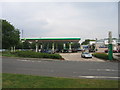
Residents of CV3 6SL have access to a range of amenities within practical reach. Retail options include M&S Stonebridge Coventry BP, Morrisons Daily Coventry, and Asda Coventry, providing everyday shopping convenience. The area’s proximity to Coventry Airport and multiple railway stations adds to its accessibility for travel and commuting. Locally, landmarks such as Spencer Park, opened in 1883, offer green space for recreation, while the Earlsdon Clock, a community-funded symbol of the area’s history, stands as a notable feature. The presence of King Henry VIII School and historic churches like St. Barbara’s Church reflects the area’s educational and cultural heritage. Public houses such as the Royal Oak and City Arms, dating back to the 1850s, contribute to a sense of local character. The mix of retail, transport, and historical sites creates a lifestyle that balances practicality with a touch of tradition.
Amenities
Schools
| Rank | School | Type | Entry gender | Ages |
|---|
Explore more schools in this area
Go to Schools tabDemographics
The population of CV3 6SL is 1,711, with a median age of 47, indicating a mature demographic. The most common age range is adults aged 30–64, reflecting a community that is largely established and settled. Home ownership is exceptionally high at 94%, suggesting a strong sense of permanence and investment in the area. The predominant accommodation type is houses, which aligns with the suburban character of the ward. The predominant ethnic group is White, though specific diversity metrics are not provided in the data. The absence of detailed information on household types or deprivation levels means that while the area appears stable, further local insights might reveal nuances about its social fabric. The high home ownership rate and age profile suggest a community focused on long-term living, with fewer transient residents. This stability likely contributes to a cohesive, neighbourly environment.
Household Size
Accommodation Type
Tenure
Ethnic Group
Religion
Household Composition
Age
Household Deprivation
NS-SEC
Explore more demographic insights in this area
Go to Demographics tabPlanning
Planning Constraints
- Flood RiskPremium
- Ramsar Wetland SitesPremium
- Area of Outstanding Natural BeautyPremium
- Protected Nature ReservePremium
- Protected WoodlandPremium