Area Overview for CV3 6SA
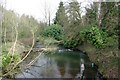
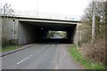
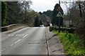
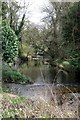
Photos of CV3 6SA

Area Information
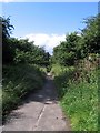
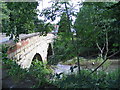
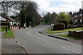
CV3 6SA, a small residential postcode in England’s West Midlands, lies within the historic Earlsdon suburb of Coventry. With a population of 1,711, it reflects a tight-knit community shaped by its 19th-century origins as a planned garden village. Established in 1852 by the Coventry Freehold Land Society, the area was designed as a sanctuary for watchmakers and professionals, with early development centred on eight streets like Earlsdon Street and Warwick Street. Today, it retains a quiet suburban character, blending historical charm with modern convenience. Residents benefit from proximity to Coventry’s city centre, just one mile away, while the area’s low crime rate and flood risk-free status ensure a stable living environment. The presence of landmarks like Spencer Park and the Earlsdon Clock, funded by local residents, adds to its distinct identity. With a median age of 47 and a predominantly White population, CV3 6SA appeals to families and professionals seeking a balanced lifestyle between heritage and practicality.
- Area Type
- Postcode
- Area Size
- Not available
- Population
- 1711
- Population Density
- 5555 people/km²
CV3 6SA is predominantly an owner-occupied area, with 94% of homes owned by residents rather than rented. The housing stock consists almost entirely of houses, reflecting a suburban layout with limited high-density development. This composition suggests a market where property values are likely to be stable, as demand from long-term residents and families seeking traditional housing dominates. The small size of the postcode means the immediate surrounding areas may offer more options for buyers, though the area’s character as a historic garden village could limit modern redevelopment. For those considering purchase, the high home ownership rate indicates a low likelihood of rental competition, making it a viable choice for those prioritising property stability and a settled community environment.
House Prices in CV3 6SA
No properties found in this postcode.
Energy Efficiency in CV3 6SA
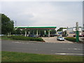
Living in CV3 6SA offers access to a range of amenities within practical reach. Retail options include M&S Stonebridge Coventry BP, Morrisons Daily Coventry, and Asda Coventry, providing everyday shopping convenience. The area’s historical roots are reflected in landmarks such as Spencer Park, opened in 1883, and the Earlsdon Clock, a community-funded symbol of local heritage. Residents can also visit St. Barbara’s Church, the Nail Factory, and the Methodist Chapel, which add to the area’s cultural and historical fabric. The proximity to rail stations and airports enhances mobility, while the low crime rate and absence of environmental risks contribute to a peaceful lifestyle. This blend of practicality, history, and safety makes CV3 6SA appealing for those seeking a balanced, community-focused existence.
Amenities
Schools
| Rank | School | Type | Entry gender | Ages |
|---|
Explore more schools in this area
Go to Schools tabDemographics
The population of CV3 6SA is 1,711, with a median age of 47 and the majority of residents aged 30–64. This suggests a community of established professionals and families, with limited representation of younger or older demographics. Home ownership is exceptionally high at 94%, indicating a stable, long-term resident base. The area is composed almost entirely of houses, reflecting a preference for single-family living over flats or apartments. The predominant ethnic group is White, with no specific data provided on minority representation. The high home ownership rate and mature age profile suggest a community focused on continuity and low turnover. While no deprivation data is available, the absence of significant planning constraints or environmental risks implies a quality of life supported by infrastructure and amenities.
Household Size
Accommodation Type
Tenure
Ethnic Group
Religion
Household Composition
Age
Household Deprivation
NS-SEC
Explore more demographic insights in this area
Go to Demographics tabPlanning
Planning Constraints
- Flood RiskPremium
- Ramsar Wetland SitesPremium
- Area of Outstanding Natural BeautyPremium
- Protected Nature ReservePremium
- Protected WoodlandPremium