Area Overview for CV3 6HW
Photos of CV3 6HW
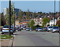
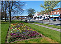
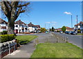
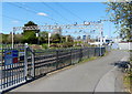
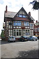
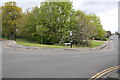
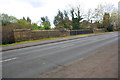
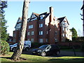
100 photos from this area
Area Information
Key information about the CV3 6HW including its size, population, and administrative classification.
- Area Type
- Postcode
- Area Size
- 1.0 hectares
- Population
- 1621
- Population Density
- 4136 people/km²
House Prices in CV3 6HW
18
Properties
£238,875
Average Sold Price
£72,000
Lowest Price
£415,000
Highest Price
Showing 18 properties
| Address | Type | Beds | Baths | Last Sale Price | Last Sale Date | |
|---|---|---|---|---|---|---|
| 33 Humphrey Burtons Road, Coventry, CV3 6HW | Semi-detached | 3 | 1 | £415,000 | Jan 2025 | |
| 45 Humphrey Burtons Road, Coventry, CV3 6HW | Semi-detached | 3 | 1 | £295,000 | Sep 2019 | |
| 43 Humphrey Burtons Road, Coventry, CV3 6HW | Semi-detached | 1 | 1 | £317,000 | Feb 2018 | |
| 29 Humphrey Burtons Road, Coventry, CV3 6HW | Semi-detached | 4 | - | £310,000 | May 2017 | |
| 39 Humphrey Burtons Road, Coventry, CV3 6HW | Semi-detached | - | - | £270,000 | May 2006 | |
| 21 Humphrey Burtons Road, Coventry, CV3 6HW | house | - | - | £147,000 | Oct 1999 | |
| 11 Humphrey Burtons Road, Coventry, CV3 6HW | Detached | - | - | £85,000 | May 1997 | |
| 41 Humphrey Burtons Road, Coventry, CV3 6HW | Semi-detached | - | - | £72,000 | Feb 1997 | |
| 31 Humphrey Burtons Road, Coventry, CV3 6HW | Semi-detached | - | - | - | - | |
| 35 Humphrey Burtons Road, Coventry, CV3 6HW | Semi-detached | - | - | - | - |
Page 1 of 2
Energy Efficiency in CV3 6HW
Amenities
Schools
| Rank | School | Type | Entry gender | Ages |
|---|
Explore more schools in this area
Go to Schools tabDemographics
Household Size
Family (3-5 people)
most common
Accommodation Type
Houses
most common
Tenure
82
majority
Ethnic Group
White
most common
Religion
N/A
most common
Household Composition
N/A
most common
Age
47
median
Adults (30-64 years)
most common
Household Deprivation
N/A
with no deprivation
NS-SEC
45
in Lower managerial occupations
Explore more demographic insights in this area
Go to Demographics tabPlanning
Planning Constraints
- Flood RiskPremium
- Ramsar Wetland SitesPremium
- Area of Outstanding Natural BeautyPremium
- Protected Nature ReservePremium
- Protected WoodlandPremium