Area Overview for CV3 6FZ
Photos of CV3 6FZ
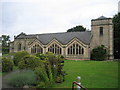
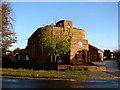
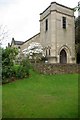
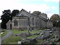
27 photos from this area
Area Information
Key information about the CV3 6FZ including its size, population, and administrative classification.
- Area Type
- Postcode
- Area Size
- 1.3 hectares
- Population
- 1711
- Population Density
- 5555 people/km²
House Prices in CV3 6FZ
28
Properties
£287,816
Average Sold Price
£90,000
Lowest Price
£472,000
Highest Price
Showing 28 properties
| Address | Type | Beds | Baths | Last Sale Price | Last Sale Date | |
|---|---|---|---|---|---|---|
| 16 Maidavale Crescent, Coventry, CV3 6FZ | Semi-detached | 3 | 1 | £415,000 | Apr 2024 | |
| 10 Maidavale Crescent, Coventry, CV3 6FZ | house | - | - | £472,000 | Dec 2020 | |
| 1 Maidavale Crescent, Coventry, CV3 6FZ | Semi-detached | 3 | 1 | £370,000 | Nov 2020 | |
| 7 Maidavale Crescent, Coventry, CV3 6FZ | Semi-detached | 3 | 1 | £360,000 | Oct 2020 | |
| 11 Maidavale Crescent, Coventry, CV3 6FZ | Semi-detached | 3 | 1 | £324,000 | Apr 2019 | |
| 2 Maidavale Crescent, Coventry, CV3 6FZ | house | - | - | £375,000 | Mar 2018 | |
| 18 Maidavale Crescent, Coventry, CV3 6FZ | Semi-detached | 3 | 1 | £360,000 | Jan 2018 | |
| 14 Maidavale Crescent, Coventry, CV3 6FZ | Semi-detached | - | - | £310,000 | Nov 2017 | |
| 12 Maidavale Crescent, Coventry, CV3 6FZ | house | - | - | £387,000 | Jul 2017 | |
| 9 Maidavale Crescent, Coventry, CV3 6FZ | house | - | - | £310,000 | Nov 2016 |
Page 1 of 3
Energy Efficiency in CV3 6FZ
Amenities
Schools
| Rank | School | Type | Entry gender | Ages |
|---|
Explore more schools in this area
Go to Schools tabDemographics
Household Size
Family (3-5 people)
most common
Accommodation Type
Houses
most common
Tenure
94
majority
Ethnic Group
White
most common
Religion
N/A
most common
Household Composition
N/A
most common
Age
47
median
Adults (30-64 years)
most common
Household Deprivation
N/A
with no deprivation
NS-SEC
50
in Lower managerial occupations
Explore more demographic insights in this area
Go to Demographics tabPlanning
Planning Constraints
- Flood RiskPremium
- Ramsar Wetland SitesPremium
- Area of Outstanding Natural BeautyPremium
- Protected Nature ReservePremium
- Protected WoodlandPremium