Area Overview for CV3 6FY
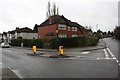
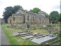
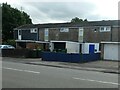
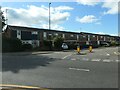
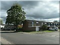
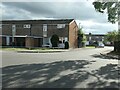
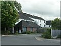
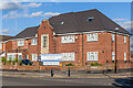
Photos of CV3 6FY
Area Information
CV3 6FY is a small, densely populated residential area in England, covering just 1.0 hectare with a population of 1,711 people. This compact postcode cluster sits within the historic Earlsdon suburb of Coventry, a planned development from 1852 that evolved into a suburban ward with a mix of heritage and modern living. The area’s proximity to Coventry City Centre—just one mile away—offers easy access to urban amenities while retaining a distinct character shaped by its 19th-century origins. Earlsdon’s legacy as a garden village for Coventry’s watchmakers is still visible in its tree-lined streets and landmarks like the Earlsdon Clock. Daily life here is defined by a tight-knit community, with a median age of 47 and a majority of residents aged 30–64. The high home ownership rate (94%) suggests stability, and the predominantly White population reflects a long-standing local identity. Despite its small size, the area’s density—over 164,000 people per square kilometre—means residents are close to shops, schools, and transport links, blending suburban tranquillity with urban convenience.
- Area Type
- Postcode
- Area Size
- 1.0 hectares
- Population
- 1711
- Population Density
- 5555 people/km²
CV3 6FY is a predominantly owner-occupied area, with 94% of homes owned by residents rather than rented. The accommodation type is exclusively houses, which is typical of suburban developments like Earlsdon. This suggests a housing stock that caters to families and individuals seeking larger, more permanent residences. Given the area’s small size—just 1.0 hectare—and high population density, the property market is likely limited to the immediate postcode, with buyers needing to consider nearby areas for additional options. The high home ownership rate indicates a stable market with little turnover, which can be advantageous for buyers seeking long-term value. However, the scarcity of available properties may make competition fierce. The presence of houses rather than flats or apartments also means the area is less suited to short-term rentals or younger buyers seeking smaller units. For those prioritising ownership in a low-density, suburban setting, CV3 6FY offers a compact but well-established option.
House Prices in CV3 6FY
Showing 22 properties
| Address | Type | Beds | Baths | Last Sale Price | Last Sale Date | |
|---|---|---|---|---|---|---|
| 109 Baginton Road, Coventry, CV3 6FY | Semi-detached | 4 | 2 | £350,000 | Feb 2023 | |
| 117 Baginton Road, Coventry, CV3 6FY | Semi-detached | 3 | 1 | £469,995 | Aug 2021 | |
| 139 Baginton Road, Coventry, CV3 6FY | house | - | - | £342,000 | May 2021 | |
| 129 Baginton Road, Coventry, CV3 6FY | house | - | - | £310,000 | Apr 2019 | |
| 127 Baginton Road, Coventry, CV3 6FY | house | - | - | £310,000 | Dec 2018 | |
| 119 Baginton Road, Coventry, CV3 6FY | Semi-detached | 4 | 3 | £340,000 | Sep 2017 | |
| 145 Baginton Road, Coventry, CV3 6FY | house | 3 | - | £267,000 | Sep 2012 | |
| 135 Baginton Road, Coventry, CV3 6FY | house | 3 | - | £249,950 | Mar 2010 | |
| 131 Baginton Road, Coventry, CV3 6FY | Semi-detached | - | - | £266,000 | Aug 2007 | |
| 133 Baginton Road, Coventry, CV3 6FY | house | - | - | £250,000 | Mar 2007 |
Energy Efficiency in CV3 6FY
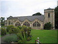
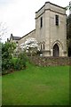
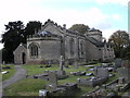
Living in CV3 6FY offers access to a range of amenities within practical reach. Retail options include major stores like M&S Stonebridge Coventry BP, Morrisons Daily Coventry, and Asda Coventry, ensuring everyday shopping needs are met. The area’s historical roots are reflected in landmarks such as Spencer Park, opened in 1883, and the Earlsdon Clock, a community-funded symbol of local pride. Educational facilities include King Henry VIII School, built in 1885, serving families in the area. Leisure options are enhanced by nearby green spaces and historical sites, such as St. Barbara’s Church and the Nail Factory, which once housed Allard Cycles. The presence of multiple rail stations and proximity to Coventry’s city centre mean residents can enjoy both suburban tranquillity and urban vibrancy. The mix of retail, education, and green spaces creates a balanced lifestyle, blending convenience with a sense of community rooted in the area’s 19th-century heritage.
Amenities
Schools
| Rank | School | Type | Entry gender | Ages |
|---|
Explore more schools in this area
Go to Schools tabDemographics
The population of CV3 6FY is 1,711, with a median age of 47, indicating a mature demographic skewed toward adults aged 30–64. This age range dominates, suggesting a community of established professionals and families. Home ownership is exceptionally high at 94%, reflecting a preference for long-term residency over rental properties. The accommodation type is predominantly houses, which aligns with the area’s suburban layout and historical development as a garden village. The predominant ethnic group is White, which, combined with the age profile, points to a stable, long-settled community. The high population density—164,578 people per square kilometre—means living spaces are closely packed, which can enhance convenience but may limit privacy. This density also implies proximity to amenities, though it may contribute to a sense of compactness. The data does not indicate significant deprivation, but the high home ownership and age profile suggest a community prioritising stability over transient lifestyles.
Household Size
Accommodation Type
Tenure
Ethnic Group
Religion
Household Composition
Age
Household Deprivation
NS-SEC
Explore more demographic insights in this area
Go to Demographics tabPlanning
Planning Constraints
- Flood RiskPremium
- Ramsar Wetland SitesPremium
- Area of Outstanding Natural BeautyPremium
- Protected Nature ReservePremium
- Protected WoodlandPremium