Area Overview for CV3 6FP
Photos of CV3 6FP
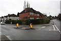
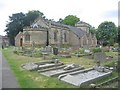
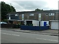
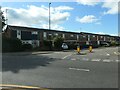
27 photos from this area
Area Information
Key information about the CV3 6FP including its size, population, and administrative classification.
- Area Type
- Postcode
- Area Size
- 8746 m²
- Population
- 1482
- Population Density
- 4079 people/km²
House Prices in CV3 6FP
11
Properties
£359,008
Average Sold Price
£104,050
Lowest Price
£615,000
Highest Price
Showing 11 properties
| Address | Type | Beds | Baths | Last Sale Price | Last Sale Date | |
|---|---|---|---|---|---|---|
| 67 Baginton Road, Coventry, CV3 6FP | Detached | 5 | 3 | £587,000 | Sep 2025 | |
| 65 Baginton Road, Coventry, CV3 6FP | Retail | 4 | 1 | £615,000 | Mar 2022 | |
| 81 Baginton Road, Coventry, CV3 6FP | house | - | - | £348,000 | Jul 2018 | |
| 69 Baginton Road, Coventry, CV3 6FP | house | - | - | £265,000 | Nov 2013 | |
| 73 Baginton Road, Coventry, CV3 6FP | house | 4 | - | £235,000 | Nov 2010 | |
| 75 Baginton Road, Coventry, CV3 6FP | Terraced | - | - | £104,050 | Aug 1997 | |
| Manse, 83 Baginton Road, Coventry, CV3 6FP | Detached | 5 | 2 | - | - | |
| Church Hall, Baginton Road United Reformed Church, Baginton Road, Coventry, CV3 6FP | commercial | - | - | - | - | |
| 79 Baginton Road, Coventry, CV3 6FP | Semi-detached | - | - | - | - | |
| 77 Baginton Road, Coventry, CV3 6FP | house | - | - | - | - |
Page 1 of 2
Energy Efficiency in CV3 6FP
Amenities
Schools
| Rank | School | Type | Entry gender | Ages |
|---|
Explore more schools in this area
Go to Schools tabDemographics
Household Size
Family (3-5 people)
most common
Accommodation Type
Houses
most common
Tenure
92
majority
Ethnic Group
White
most common
Religion
N/A
most common
Household Composition
N/A
most common
Age
47
median
Adults (30-64 years)
most common
Household Deprivation
N/A
with no deprivation
NS-SEC
51
in Lower managerial occupations
Explore more demographic insights in this area
Go to Demographics tabPlanning
Planning Constraints
- Flood RiskPremium
- Ramsar Wetland SitesPremium
- Area of Outstanding Natural BeautyPremium
- Protected Nature ReservePremium
- Protected WoodlandPremium