Area Overview for CV3 6ER
Photos of CV3 6ER
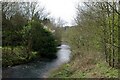
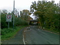
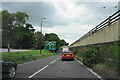

46 photos from this area
Area Information
Key information about the CV3 6ER including its size, population, and administrative classification.
- Area Type
- Postcode
- Area Size
- 3.6 hectares
- Population
- 2124
- Population Density
- 3382 people/km²
House Prices in CV3 6ER
26
Properties
£479,154
Average Sold Price
£122,000
Lowest Price
£910,000
Highest Price
Showing 26 properties
| Address | Type | Beds | Baths | Last Sale Price | Last Sale Date | |
|---|---|---|---|---|---|---|
| 114 St Martins Road, Coventry, CV3 6ER | Detached | 4 | 3 | £775,000 | Sep 2024 | |
| 118 St Martins Road, Coventry, CV3 6ER | Detached | 4 | 2 | £910,000 | Dec 2022 | |
| 134 St Martins Road, Coventry, CV3 6ER | house | - | - | £580,000 | Jun 2022 | |
| 128 St Martins Road, Coventry, CV3 6ER | house | - | - | £500,000 | Sep 2021 | |
| 122 St Martins Road, Coventry, CV3 6ER | house | - | - | £330,000 | Sep 2020 | |
| 132 St Martins Road, Coventry, CV3 6ER | Detached | 4 | 2 | £437,000 | Jun 2020 | |
| 140 St Martins Road, Coventry, CV3 6ER | Detached | 3 | 2 | £310,000 | Oct 2019 | |
| 92 St Martins Road, Coventry, CV3 6ER | house | - | - | £460,000 | Oct 2010 | |
| 116 St Martins Road, Coventry, CV3 6ER | house | - | - | £620,000 | Feb 2007 | |
| 120 St Martins Road, Coventry, CV3 6ER | Detached | - | - | £640,000 | Aug 2006 |
Page 1 of 3
Energy Efficiency in CV3 6ER
Amenities
Schools
| Rank | School | Type | Entry gender | Ages |
|---|
Explore more schools in this area
Go to Schools tabDemographics
Household Size
Family (3-5 people)
most common
Accommodation Type
Houses
most common
Tenure
89
majority
Ethnic Group
White
most common
Religion
N/A
most common
Household Composition
N/A
most common
Age
47
median
Adults (30-64 years)
most common
Household Deprivation
N/A
with no deprivation
NS-SEC
47
in Lower managerial occupations
Explore more demographic insights in this area
Go to Demographics tabPlanning
Planning Constraints
- Flood RiskPremium
- Ramsar Wetland SitesPremium
- Area of Outstanding Natural BeautyPremium
- Protected Nature ReservePremium
- Protected WoodlandPremium