Area Overview for CV3 6DR
Photos of CV3 6DR
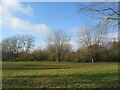
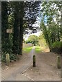
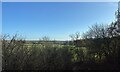
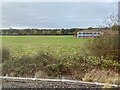
23 photos from this area
Area Information
Key information about the CV3 6DR including its size, population, and administrative classification.
- Area Type
- Postcode
- Area Size
- 9.9 hectares
- Population
- 4079
- Population Density
- 130 people/km²
House Prices in CV3 6DR
35
Properties
£202,402
Average Sold Price
£51,000
Lowest Price
£465,000
Highest Price
Showing 35 properties
| Address | Type | Beds | Baths | Last Sale Price | Last Sale Date | |
|---|---|---|---|---|---|---|
| 174 Gretna Road, Coventry, CV3 6DR | Terraced | 3 | 1 | £285,000 | Sep 2024 | |
| 226 Gretna Road, Coventry, CV3 6DR | Semi-detached | 4 | 3 | £465,000 | Feb 2023 | |
| 216 Gretna Road, Coventry, CV3 6DR | Semi-detached | 3 | 1 | £375,000 | Feb 2023 | |
| 196 Gretna Road, Coventry, CV3 6DR | house | - | - | £357,500 | Aug 2022 | |
| 168 Gretna Road, Coventry, CV3 6DR | Retail | 3 | 1 | £290,000 | Jun 2022 | |
| 200 Gretna Road, Coventry, CV3 6DR | house | - | - | £205,000 | Nov 2019 | |
| 210 Gretna Road, Coventry, CV3 6DR | Semi-detached | 3 | 1 | £240,000 | Jul 2019 | |
| 206 Gretna Road, Coventry, CV3 6DR | Terraced | 3 | 1 | £215,000 | Mar 2019 | |
| 218 Gretna Road, Coventry, CV3 6DR | house | - | - | £296,000 | Jan 2019 | |
| 204 Gretna Road, Coventry, CV3 6DR | Terraced | - | - | £200,000 | Apr 2018 |
Page 1 of 4
Energy Efficiency in CV3 6DR
Amenities
Schools
| Rank | School | Type | Entry gender | Ages |
|---|
Explore more schools in this area
Go to Schools tabDemographics
Household Size
Two person
most common
Accommodation Type
Houses
most common
Tenure
80
majority
Ethnic Group
White
most common
Religion
N/A
most common
Household Composition
N/A
most common
Age
22
median
Young Adults (15-29 years)
most common
Household Deprivation
N/A
with no deprivation
NS-SEC
19
in Lower managerial occupations
Explore more demographic insights in this area
Go to Demographics tabPlanning
Planning Constraints
- Flood RiskPremium
- Ramsar Wetland SitesPremium
- Area of Outstanding Natural BeautyPremium
- Protected Nature ReservePremium
- Protected WoodlandPremium