Area Overview for CV3 6AQ
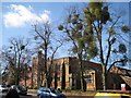
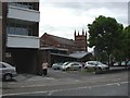
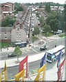
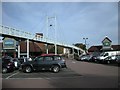
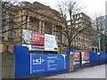
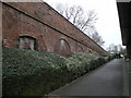
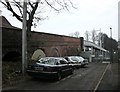
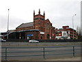
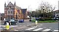
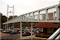
Photos of CV3 6AQ


Area Information
CV3 6AQ represents a specific residential cluster within the Earlsdon ward, located approximately one mile southwest of Coventry City Centre. This small postcode covers just 1.4 hectares and houses a population of 1,343 residents. The area functions as a compact suburban enclave where daily life is defined by proximity to local amenities and established community infrastructure. Earlsdon itself was established as a planned development in 1852 by the Coventry Freehold Land Society, which purchased a 31-acre estate formerly known as John Moore's farmhouse, Six Fields. The area grew slowly, with only 114 of the original 251 plots built on by 1871, reflecting a measured expansion typical of garden village suburbs. By 1890, Earlsdon had been incorporated into Coventry's municipal boundary, facilitated significantly by the opening of Albany Road in 1897 which provided direct access to the city. This historical context shapes the current character of CV3 6AQ, where watch-making heritage gave way to engineering and motor industries. Residents live in an environment that balances suburban quiet with reasonable access to the wider city network, situated firmly within the West Midlands.
- Area Type
- Postcode
- Area Size
- 1.4 hectares
- Population
- 1343
- Population Density
- 1417 people/km²
The housing stock in CV3 6AQ is defined by a strong preference for house ownership over renting. Data confirms that 84% of households are owner-occupiers, creating a market where properties are held with long-term intent. The predominant accommodation type is houses, consistent with the planned suburban origins of Earlsdon established in the mid-19th century. This ownership model suggests that buyers can expect a stock dominated by freehold properties rather than leasehold flats or rental sectors. The area consists of a small residential cluster, making individual property sales events more impactful on the local character than in a high-volume housing estate. Potential buyers are essentially entering a closed loop of established homes where transaction volumes may be lower than in larger districts. The high owner-occupier rate implies that tenancies are rare, and the housing choices are largely defined by the existing stock laid out since the 1850s. This environment suits individuals or families looking for stability and control over their living space within a curated postcodes network.
House Prices in CV3 6AQ
Showing 1 properties
| Address | Type | Beds | Baths | Last Sale Price | Last Sale Date | |
|---|---|---|---|---|---|---|
| Sixth Form Centre, King Henry Viii School, Warwick Road, Coventry, CV3 6AQ | commercial | - | - | - | - |
Energy Efficiency in CV3 6AQ
Residents of CV3 6AQ enjoy convenient access to a range of retail, rail, and airport amenities within practical reach. The nearest retail options include Sainsburys Coventry, M&S Coventry Rail SF, and Aldi Unit 8 & 9 Central, providing sufficient daily shopping requirements without the need for shopping centre trips. Transport links are supported by five rail stations, including Canley Railway Station, Tile Hill Railway Station, and Coventry Arena Railway Station, offering flexible commuting possibilities. Additionally, two airports are nearby, specifically Coventry Airport, which may appeal to aviation enthusiasts or those requiring regional air transport. Local landmarks such as Spencer Park, opened in 1883, and St. Barbara's Church, completed in 1913, anchor the social fabric of the neighbourhood. The area also features historical pubs like the Royal Oak on Earlsdon Street and Moor Street, contributing to the traditional English village feel. These facilities ensure that daily life balances convenience with the charm of a historic suburb.
Amenities
Schools
Families in CV3 6AQ have access to three independent schools located nearby. These are Coventry Preparatory School, Davenport Lodge School, and King Henry VIII School. The presence of these institutions provides options for parents seeking private education without needing to travel far beyond the immediate postcodes. The mix of independent schools suggests a community value system that prioritises alternative educational pathways over the state sector. King Henry VIII School is a notable landmark in the area, originally built in 1885, while Coventry Preparatory School and Davenport Lodge School continue to serve the local community. The concentration of independent institutions indicates that the demographic of children in the area is likely supported by families with the means to access private tutoring or schooling. These schools offer structured education environments distinct from general public schools, catering to specific academic or religious philosophies common in the West Midlands.
| Rank | School | Type | Entry gender | Ages |
|---|
Explore more schools in this area
Go to Schools tabDemographics
The community within CV3 6AQ is established and stable, characterised by a high level of residential security. Eighty-four percent of residents owner-occupy their homes, indicating a deeply rooted population rather than a transient rental market. The predominant ethnic group is White, and the accommodation type consists primarily of houses, reflecting the area's suburban origins. The demographic profile is dominated by adults aged between 30 and 64 years, with a median age of 47. This age structure suggests a neighbourhood where long-term families and mature individuals prefer stability over rapid change. The population density stands at 94,686 people per square kilometre, a figure that results from the specific calculation of the entire postal district data against the total land area provided. Despite the high density figure, the restricted size of the postcode limits the immediate feeling of crowding. The area appeals to those seeking a settlement with a clear social identity and established property tenure rather than new-build speculation.
Household Size
Accommodation Type
Tenure
Ethnic Group
Religion
Household Composition
Age
Household Deprivation
NS-SEC
Explore more demographic insights in this area
Go to Demographics tabPlanning
Planning Constraints
- Flood RiskPremium
- Ramsar Wetland SitesPremium
- Area of Outstanding Natural BeautyPremium
- Protected Nature ReservePremium
- Protected WoodlandPremium