Area Overview for CV3 5JE
Photos of CV3 5JE
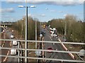
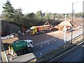
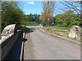
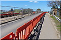
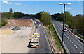
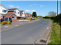
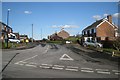
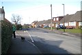
69 photos from this area
Area Information
Key information about the CV3 5JE including its size, population, and administrative classification.
- Area Type
- Postcode
- Area Size
- 8449 m²
- Population
- 1556
- Population Density
- 1223 people/km²
House Prices in CV3 5JE
24
Properties
£140,889
Average Sold Price
£45,000
Lowest Price
£276,000
Highest Price
Showing 24 properties
| Address | Type | Beds | Baths | Last Sale Price | Last Sale Date | |
|---|---|---|---|---|---|---|
| 102 Black Prince Avenue, Coventry, CV3 5JE | Flat | 1 | 1 | £92,500 | Mar 2024 | |
| 68 Black Prince Avenue, Coventry, CV3 5JE | Semi-detached | 3 | 1 | £276,000 | Dec 2023 | |
| 74 Black Prince Avenue, Coventry, CV3 5JE | Semi-detached | 3 | 1 | £182,500 | Feb 2021 | |
| 84 Black Prince Avenue, Coventry, CV3 5JE | Flat | 1 | 1 | £218,000 | Feb 2018 | |
| 86 Black Prince Avenue, Coventry, CV3 5JE | Semi-detached | 3 | 1 | £144,000 | Jan 2015 | |
| 72 Black Prince Avenue, Coventry, CV3 5JE | house | - | - | £155,000 | May 2013 | |
| 80 Black Prince Avenue, Coventry, CV3 5JE | Detached | 3 | 1 | £85,000 | Apr 2007 | |
| 78 Black Prince Avenue, Coventry, CV3 5JE | Semi-detached | - | - | £70,000 | Sep 2001 | |
| 70 Black Prince Avenue, Coventry, CV3 5JE | Semi-detached | - | - | £45,000 | May 1999 | |
| 82 Black Prince Avenue, Coventry, CV3 5JE | Detached | 3 | 1 | - | - |
Page 1 of 3
Energy Efficiency in CV3 5JE
Amenities
Schools
| Rank | School | Type | Entry gender | Ages |
|---|
Explore more schools in this area
Go to Schools tabDemographics
Household Size
One person
most common
Accommodation Type
Houses
most common
Tenure
53
majority
Ethnic Group
White
most common
Religion
N/A
most common
Household Composition
N/A
most common
Age
47
median
Adults (30-64 years)
most common
Household Deprivation
N/A
with no deprivation
NS-SEC
33
in Lower managerial occupations
Explore more demographic insights in this area
Go to Demographics tabPlanning
Planning Constraints
- Flood RiskPremium
- Ramsar Wetland SitesPremium
- Area of Outstanding Natural BeautyPremium
- Protected Nature ReservePremium
- Protected WoodlandPremium