Area Overview for CV3 4ST
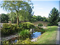
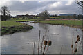
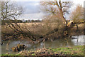
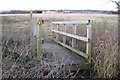
Photos of CV3 4ST


Area Information
CV3 4ST is a small residential postcode in Warwickshire, England, encompassing the village of Baginton, a historically significant settlement with roots dating back to the Domesday Book. With a population of 4,079 and a population density of 130 people per square kilometre, it reflects a tight-knit, low-density community. The area’s character is shaped by its rural charm, with landmarks such as Bagot’s Castle, a 14th-century fortress now repurposed as a visitor centre, and the Roman Lunt Fort, an archaeological site featuring a circular arena. Baginton’s proximity to Coventry and its historical ties to agriculture and industry create a blend of heritage and modern convenience. Daily life here is influenced by its small-scale nature: the village once relied on a school and local services, though many have since closed. The opening of Baginton Airport in 1935 marked a shift towards employment in aviation and construction, a legacy still evident in the area’s infrastructure. Living in CV3 4ST means navigating a quiet, low-traffic environment with easy access to nearby towns and transport links, ideal for those seeking a balance between historical depth and practicality.
- Area Type
- Postcode
- Area Size
- Not available
- Population
- 4079
- Population Density
- 130 people/km²
The property market in CV3 4ST is characterised by high home ownership (80%) and a focus on houses, which dominates the accommodation type. This suggests a market primarily catering to owner-occupiers rather than renters, likely reflecting the area’s suburban nature and appeal to families or individuals seeking stable, long-term housing. The prevalence of houses over flats or apartments may indicate limited development of high-density housing, which could affect availability for buyers seeking smaller or more affordable units. Given the small population and low density, the housing stock is likely to be spread across the village, with properties potentially offering larger gardens or outdoor space. For buyers, this implies a focus on individual homes rather than shared or rental properties, though the limited data on property types or price ranges means specific investment opportunities are unclear. The area’s historical and rural character may also influence property values, with heritage features like Bagot’s Castle or the Roman Lunt Fort potentially adding to the appeal of nearby homes.
House Prices in CV3 4ST
No properties found in this postcode.
Energy Efficiency in CV3 4ST
Residents of CV3 4ST have access to a range of local amenities within practical reach. Retail options include Aldi in Willenhall, Iceland in Coventry 2, and the Heart of England Co-operative in Ryton-on-Dunsmore, providing everyday shopping needs. The area’s rail network includes Canley, Kenilworth, and Coventry Arena stations, offering links to nearby towns and cities. While the village itself has limited services, its proximity to Coventry and surrounding areas ensures access to larger retail, dining, and leisure options. The historical and natural features of the area, such as Bagot’s Castle and the Roman Lunt Fort, contribute to a distinct local character, though modern amenities like pubs, restaurants, and community centres are not detailed in the data. The absence of a local school since 1976 means families may need to rely on nearby institutions in Coventry or Kenilworth. Overall, the lifestyle in CV3 4ST balances historical interest with practical connectivity, though its small size limits the density of on-site services.
Amenities
Schools
| Rank | School | Type | Entry gender | Ages |
|---|
Explore more schools in this area
Go to Schools tabDemographics
The population of CV3 4ST is predominantly young, with a median age of 22 and the most common age range being 15–29 years. This suggests a community skewed towards students, early-career professionals, or families with younger children. Home ownership is high at 80%, indicating a stable, long-term resident base. The accommodation type is primarily houses, reflecting a suburban or semi-rural layout rather than high-density housing. The predominant ethnic group is White, with no specific data on other demographics provided. The low population density of 130 people per square kilometre implies spacious living conditions, though this also means limited proximity to urban amenities. The absence of detailed deprivation data means that while the area appears to have a youthful, owner-occupied demographic, its socio-economic challenges are not quantified here. For quality of life, the age profile suggests a dynamic but possibly transient population, with potential for community-driven initiatives to address local needs.
Household Size
Accommodation Type
Tenure
Ethnic Group
Religion
Household Composition
Age
Household Deprivation
NS-SEC
Explore more demographic insights in this area
Go to Demographics tabPlanning
Planning Constraints
- Flood RiskPremium
- Ramsar Wetland SitesPremium
- Area of Outstanding Natural BeautyPremium
- Protected Nature ReservePremium
- Protected WoodlandPremium