Area Overview for CV3 4LE
Photos of CV3 4LE


Area Information
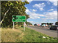
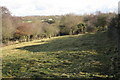
CV3 4LE represents a specific postcode cluster within the larger Cheylesmore estate, a planned residential community developed between 1934 and 1939. This compact zone covers just 4.4 hectares and currently houses 1,259 residents. The area is situated at coordinates 52.400818, -1.514929 in the West Midlands, reflecting its integration into the broader city fabric. Life here moves at a measured pace, defined by proximity to historic landmarks like Cheylesmore Manor House, which now serves as the local register office. The postal designation often links this site to the CV1 2EU ward in broader administrative contexts, yet the CV3 4LE code identifies a focused residential pocket. Original history shows the estate was designed as a showcase for Coventry, featuring a central community centre completed by 1938 and a manor house with medieval roots dating back to the 13th century. Today, the legacy of that era remains visible in the surrounding architecture and community facilities. Residents enjoy a neighbourhood shaped by both modern planning and centuries of local heritage.
- Area Type
- Postcode
- Area Size
- 4.4 hectares
- Population
- 1259
- Population Density
- 1118 people/km²
The property landscape in CV3 4LE is defined by a high level of ownership and specific housing architecture. Currently, 54% of residents own their homes, signifying a stable, owner-occupied character typical of mature estates. The predominant accommodation type is flats, which aligns with the planned density of the 1930s development that originally formed this part of the Cheylesmore ward. This configuration usually means queuing and communal living is more common than detached suburban layouts found in older ring roads. Buyers exploring homes in CV3 4LE should expect a mix of purpose-built structures alongside the wider legacy of the estate. The concentration of flats within a 4.4-hectare footprint suggests a need for efficient space utilisation in the design of these properties. Residential clusters here often command premium prices due to their proximity to the centre and amenities. Prospective buyers must weigh the security of an owner-structured environment against the potential maintenance considerations associated with flat ownership in a high-density setting.
House Prices in CV3 4LE
No properties found in this postcode.
Energy Efficiency in CV3 4LE
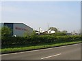
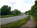
Residents of CV3 4LE enjoy convenient access to a range of practical amenities situated within walking or short driving distance. Retail options include Aldi Willenhall, Iceland Coventry 2, and Asda Abbey, providing fresh produce and household essentials. Travel needs are met by four nearby railway stations, with Canley Railway Station, Kenilworth Railway Station, and Coventry Arena Railway Station offering regular timetables. Aviation access is supported by two nearby airports, specifically Coventry Airport, which serves business travel and light aircraft operations. The area's character is further enriched by its historic corner shops on Daventry Road, which date back to 1936. These original buildings once housed newsagents, butchers, greengrocers, and confectioners, preserving a sense of traditional community commerce. The Cheylesmore Community Centre, built by 1938, remains a focal point with a library, climbing wall, and children's centre. This combination of modern retail, rail connectivity, and historic facilities creates a self-sufficient lifestyle environment.
Amenities
Schools
Families considering schools near CV3 4LE find two special educational needs provision options in close proximity. Baginton Fields School and Baginton Fields Academy stand as the primary registered institutions adjacent to the postcode. Both schools operate under the special needs category, which serves students with specific educational requirements. This arrangement indicates that the immediate vicinity prioritises specialist support rather than mainstream comprehensive or primary education for general populations. Residents with children requiring special support will benefit from the direct access these institutions provide. While the estate historically housed a youth centre football club and children's centre established in 2008, current educational offerings focus heavily on these two specialised academies. Buyers seeking mainstream schools must look beyond this immediate square mile. The presence of these two facilities reflects the specific needs of the local resident profile and the service provision available to the 1,259 people living in this cluster.
| Rank | School | Type | Entry gender | Ages |
|---|
Explore more schools in this area
Go to Schools tabDemographics
The community profile of CV3 4LE reflects a settled, mature population. The median age stands at 47 years, and adults between 30 and 64 years constitute the most common age range. With a population density of 1,118 people per square kilometre, the area is moderately dense for a residential zone. Over half of households possess a keen interest in stability, as 54% of the population are homeowners. Accommodation types are predominantly flats, indicating a housing stock suited to compact living within the designated postcode area. The predominant ethnic group is White, mirroring the traditional demographics of the wider Cheylesmore estate. This demographic composition suggests an area where long-term residents often have deep roots in the neighbourhood. The high home ownership rate and mature age profile point to a market where families and established professionals seek permanence rather than transient living arrangements.
Household Size
Accommodation Type
Tenure
Ethnic Group
Religion
Household Composition
Age
Household Deprivation
NS-SEC
Explore more demographic insights in this area
Go to Demographics tabPlanning
Planning Constraints
- Flood RiskPremium
- Ramsar Wetland SitesPremium
- Area of Outstanding Natural BeautyPremium
- Protected Nature ReservePremium
- Protected WoodlandPremium