Area Overview for CV3 4BX
Photos of CV3 4BX
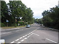
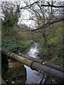
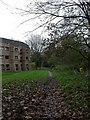
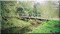

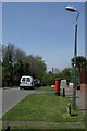
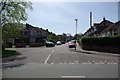
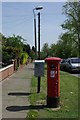
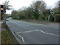

87 photos from this area
Area Information
Key information about the CV3 4BX including its size, population, and administrative classification.
- Area Type
- Postcode
- Area Size
- 7828 m²
- Population
- 1887
- Population Density
- 1247 people/km²
House Prices in CV3 4BX
22
Properties
£124,579
Average Sold Price
£52,500
Lowest Price
£188,450
Highest Price
Showing 22 properties
| Address | Type | Beds | Baths | Last Sale Price | Last Sale Date | |
|---|---|---|---|---|---|---|
| 230 London Road, Coventry, CV3 4BX | Terraced | 3 | 1 | £182,000 | Jun 2021 | |
| 214 London Road, Coventry, CV3 4BX | Terraced | 3 | 2 | £188,450 | Mar 2017 | |
| 210 London Road, Coventry, CV3 4BX | house | 3 | - | £138,000 | Jul 2015 | |
| 222 London Road, Coventry, CV3 4BX | Terraced | 3 | - | £140,000 | Apr 2015 | |
| 212 London Road, Coventry, CV3 4BX | Terraced | 3 | 1 | £104,000 | May 2014 | |
| 220 London Road, Coventry, CV3 4BX | Terraced | 3 | - | £146,000 | Aug 2013 | |
| 208 London Road, Coventry, CV3 4BX | Semi-detached | 3 | 2 | £80,000 | Sep 2011 | |
| 228 London Road, Coventry, CV3 4BX | house | - | - | £118,000 | Aug 2007 | |
| 224 London Road, Coventry, CV3 4BX | house | - | - | £130,000 | Oct 2006 | |
| 204 London Road, Coventry, CV3 4BX | Semi-detached | - | - | £126,000 | Sep 2004 |
Page 1 of 3
Energy Efficiency in CV3 4BX
Amenities
Schools
| Rank | School | Type | Entry gender | Ages |
|---|
Explore more schools in this area
Go to Schools tabDemographics
Household Size
Family (3-5 people)
most common
Accommodation Type
Houses
most common
Tenure
73
majority
Ethnic Group
White
most common
Religion
N/A
most common
Household Composition
N/A
most common
Age
47
median
Adults (30-64 years)
most common
Household Deprivation
N/A
with no deprivation
NS-SEC
34
in Lower managerial occupations
Explore more demographic insights in this area
Go to Demographics tabPlanning
Planning Constraints
- Flood RiskPremium
- Ramsar Wetland SitesPremium
- Area of Outstanding Natural BeautyPremium
- Protected Nature ReservePremium
- Protected WoodlandPremium