Area Overview for CV3 2LA
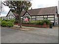
Photos of CV3 2LA


Area Information
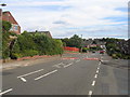
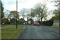
CV3 2LA is a compact residential postcode in the south-east of Coventry, encompassing parts of Binley and Willenhall. With a population of 1,494 spread over 2.4 hectares, it is a densely populated area characterised by a mix of private and council-owned homes. Historically rooted in mining, Binley evolved from a small village into a residential hub, while Willenhall, once a separate parish, now forms part of Coventry’s broader urban fabric. The area is defined by its proximity to schools, rail links, and retail amenities, making it a practical choice for families and commuters. Its compact size means residents are close to essential services, though the high population density reflects a mature community with limited space for expansion. The presence of landmarks like St Bartholomew’s Church and Brandon Wood adds a layer of local heritage, while modern connectivity ensures access to broadband and rail networks. Living here balances historical charm with contemporary convenience, though the small area’s constraints may limit options for those seeking larger properties or open spaces.
- Area Type
- Postcode
- Area Size
- 2.4 hectares
- Population
- 1494
- Population Density
- 5052 people/km²
The property market in CV3 2LA is dominated by owner-occupied homes, with 59% of residents owning their properties. The area’s accommodation is primarily houses, reflecting a traditional, low-density housing stock typical of older residential districts. Given the postcode’s small size—just 2.4 hectares—the housing stock is likely limited, with little scope for new developments. This suggests a stable market with fewer properties available for purchase, potentially leading to higher competition among buyers. The predominance of houses may appeal to those seeking more space than flats, though the high population density indicates that properties are likely smaller or closely packed. For buyers, this area may be attractive for its proximity to schools and transport, but the limited size of the postcode means that any property search would need to extend beyond immediate surroundings. The mix of owner-occupied and rental properties also implies a balance between long-term residents and those seeking temporary housing.
House Prices in CV3 2LA
Showing 64 properties
| Address | Type | Beds | Baths | Last Sale Price | Last Sale Date | |
|---|---|---|---|---|---|---|
| 58 Somerly Close, Coventry, CV3 2LA | Bungalow | 2 | 1 | £170,000 | Apr 2025 | |
| 57 Somerly Close, Coventry, CV3 2LA | Bungalow | 2 | 1 | £170,000 | Sep 2024 | |
| 55 Somerly Close, Coventry, CV3 2LA | Terraced | 3 | 1 | £190,000 | Aug 2024 | |
| 18 Somerly Close, Coventry, CV3 2LA | Terraced | 2 | 1 | £135,000 | Apr 2024 | |
| 23 Somerly Close, Coventry, CV3 2LA | Terraced | 2 | 1 | £155,000 | Mar 2024 | |
| 8 Somerly Close, Coventry, CV3 2LA | Terraced | 2 | 1 | £163,000 | Mar 2024 | |
| 29 Somerly Close, Coventry, CV3 2LA | Terraced | 2 | 1 | £175,000 | Dec 2023 | |
| 56 Somerly Close, Coventry, CV3 2LA | Bungalow | - | - | £180,000 | Jan 2023 | |
| 20 Somerly Close, Coventry, CV3 2LA | house | - | - | £145,000 | Nov 2022 | |
| 62 Somerly Close, Coventry, CV3 2LA | Bungalow | - | - | £170,000 | Sep 2022 |
Energy Efficiency in CV3 2LA
Daily life in CV3 2LA is shaped by its proximity to retail, leisure, and historical sites. Nearby shops include Lidl Binley, Morrisons Binley, and Asda Living, offering practical shopping options for groceries and household goods. The area’s rail links provide access to Coventry’s cultural and commercial hubs, while the nearby Brandon Wood and Willenhall Wood offer green spaces for walking or recreation. St Bartholomew’s Church, a grade I listed building, adds a historical dimension to the local landscape. The Village Green, established in 1989, hosts community events and is used for children’s activities, fostering a sense of local identity. The compact nature of the area means amenities are within practical reach, though the high population density may limit private outdoor space. Residents can enjoy a mix of practical retail, green spaces, and historical landmarks, creating a lifestyle that balances convenience with community engagement.
Amenities
Schools
Residents of CV3 2LA have access to several schools, including Sowe Valley Primary School, St Bartholomew’s Church of England Primary School, and Ernesford Grange Community School, all rated ‘good’ by Ofsted. St Bartholomew’s Church of England Academy and Ernesford Grange Community Academy are also nearby, though the former has a ‘satisfactory’ rating. The presence of both primary schools and academies offers families a range of educational options, from traditional state-run institutions to academies with potentially distinct curricula or governance. The ‘good’ ratings suggest a generally strong standard of education, though parents may need to consider the specific needs of their children when choosing between schools. The proximity of multiple schools within a short distance makes CV3 2LA appealing for families prioritising ease of access to education. However, the mix of ratings indicates variation in quality, requiring careful research to align with individual preferences.
| Rank | School | Type | Entry gender | Ages |
|---|
Explore more schools in this area
Go to Schools tabDemographics
The population of CV3 2LA is predominantly adults aged 30–64, with a median age of 47. This suggests a mature community, likely with established families and professionals. Home ownership rates stand at 59%, indicating a mix of owner-occupied properties and rental stock, though the exact proportion of rentals is not specified. The area is largely composed of houses, reflecting a traditional housing stock rather than flats or apartments. The predominant ethnic group is White, though no specific data on diversity or deprivation levels is provided. The high population density of 61,162 people per square kilometre implies a tightly packed residential environment, which may influence local services and infrastructure. For residents, this density could mean a strong sense of community but potentially limited private outdoor space. The age profile suggests a stable demographic, with fewer young families or retirees compared to other areas, shaping the local character and demand for amenities.
Household Size
Accommodation Type
Tenure
Ethnic Group
Religion
Household Composition
Age
Household Deprivation
NS-SEC
Explore more demographic insights in this area
Go to Demographics tabPlanning
Planning Constraints
- Flood RiskPremium
- Ramsar Wetland SitesPremium
- Area of Outstanding Natural BeautyPremium
- Protected Nature ReservePremium
- Protected WoodlandPremium