Area Overview for CV3 2JU
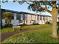
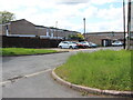
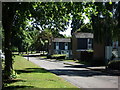
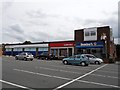
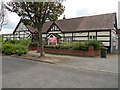
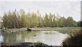
Photos of CV3 2JU

Area Information
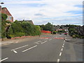
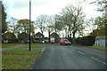
CV3 2JU is a compact residential postcode in the south-east of Coventry, spanning 1.8 hectares and home to 1,494 people. Its high population density of 83,567 people per square kilometre reflects a tightly knit community, typical of areas that evolved from historical mining villages. Binley and Willenhall, the broader wards encompassing this postcode, have roots in the Domesday Book and were shaped by the Coombe Estate, later developed into housing after the 1920s. Today, the area blends private residences with council-owned properties, creating a mix of long-established and newer homes. Daily life here is defined by proximity to local amenities, schools, and transport links, with a quiet residential character. The presence of landmarks like St Bartholomew’s Church and nature reserves such as Brandon Wood adds a layer of historical and green space appeal. While the area has grown from its industrial past, it retains a community-focused identity, with social hubs like the Coombe Social Club and public spaces like the Village Green fostering local connections. Living in CV3 2JU offers a balance of convenience, history, and a strong sense of place.
- Area Type
- Postcode
- Area Size
- 1.8 hectares
- Population
- 1494
- Population Density
- 5052 people/km²
The property market in CV3 2JU is dominated by owner-occupied homes, with 59% of residents owning their properties. The accommodation type is primarily houses, reflecting a suburban, low-density residential pattern. This contrasts with areas dominated by flats or high-rise housing, suggesting a more traditional, family-oriented housing stock. The small area size—just 1.8 hectares—means the housing stock is limited, likely comprising a mix of older homes from the 20th century and newer developments built on former industrial land. As a small postcode cluster, the market may have limited inventory, which could benefit buyers seeking a stable, low-risk investment. The presence of both private and council-owned properties indicates a mix of long-term residents and potential rental opportunities. For buyers, the area’s compact size and proximity to amenities like schools and transport make it attractive, though the narrow footprint may limit scope for large-scale development.
House Prices in CV3 2JU
Showing 27 properties
| Address | Type | Beds | Baths | Last Sale Price | Last Sale Date | |
|---|---|---|---|---|---|---|
| 21 Quorn Way, Coventry, CV3 2JU | Semi-detached | 4 | 1 | £310,000 | Nov 2023 | |
| 33 Quorn Way, Coventry, CV3 2JU | house | - | - | £240,000 | Sep 2021 | |
| 5 Quorn Way, Coventry, CV3 2JU | house | 3 | 1 | £200,000 | Jun 2019 | |
| 23 Quorn Way, Coventry, CV3 2JU | Semi-detached | 3 | 2 | £215,000 | Sep 2017 | |
| 27 Quorn Way, Coventry, CV3 2JU | Semi-detached | 3 | 1 | £196,000 | Jul 2017 | |
| 19 Quorn Way, Coventry, CV3 2JU | Semi-detached | 7 | 3 | £275,000 | Sep 2016 | |
| 31 Quorn Way, Coventry, CV3 2JU | Detached | 3 | 1 | £235,000 | Aug 2016 | |
| 18 Quorn Way, Coventry, CV3 2JU | Maisonette | - | - | £715,000 | Mar 2016 | |
| 15 Quorn Way, Coventry, CV3 2JU | Semi-detached | 3 | 1 | £132,500 | Jul 2012 | |
| 45 Quorn Way, Coventry, CV3 2JU | Semi-detached | - | - | £126,000 | Aug 2005 |
Energy Efficiency in CV3 2JU
The lifestyle in CV3 2JU is shaped by a blend of historical landmarks, green spaces, and practical amenities. Residents have access to St Bartholomew’s Church, a grade I listed building with historical significance, and Brandon Wood, an ancient woodland managed by the Friends of Brandon Wood. Nearby, Willenhall Wood offers a nature reserve for walks and recreation. Retail options include Lidl Binley and Morrisons Binley, while rail stations provide links to Coventry and surrounding areas. The area’s character is enhanced by social hubs like the Coombe Social Club and the Village Green, which hosts community events. The compact size of the postcode means amenities are within walking distance, fostering a sense of convenience. However, the lack of major cultural or entertainment venues may require travel for more specialised activities. Overall, the area offers a quiet, family-oriented lifestyle with a strong connection to local heritage and nature.
Amenities
Schools
Residents of CV3 2JU have access to a range of primary and academy schools, including Sowe Valley Primary School (Ofsted rating: good), St Bartholomew’s Church of England Primary School, and Ernesford Grange Community School. The area also includes two academies: St Bartholomew’s Church of England Academy (Ofsted rating: satisfactory) and Ernesford Grange Community Academy (Ofsted rating: good). This mix of school types provides families with options, from traditional state-funded primaries to academies with distinct educational approaches. The presence of two schools with ‘good’ Ofsted ratings suggests a strong foundation for primary education, while the ‘satisfactory’ rating at one academy indicates areas for improvement. For parents, the proximity of multiple schools within walking distance is a key advantage, supporting a family-friendly environment. The blend of school types also allows for flexibility in choosing educational pathways, though the overall quality is generally aligned with average regional standards.
| Rank | School | Type | Entry gender | Ages |
|---|
Explore more schools in this area
Go to Schools tabDemographics
The population of CV3 2JU is predominantly adults aged 30–64, with a median age of 47. This suggests a community of middle-aged and older residents, likely settled in long-term housing. Home ownership rates stand at 59%, indicating a stable residential base, while the remaining 41% are likely renters. The area is characterised by houses rather than flats, reflecting a traditional suburban layout. The predominant ethnic group is White, aligning with broader trends in the West Midlands. The high proportion of adults in the 30–64 age range implies a mature demographic, possibly with established families and a lower proportion of young professionals or students. This profile may influence local services and amenities, with schools and community facilities tailored to older generations. The absence of specific deprivation data means quality of life is inferred from the area’s safety, connectivity, and amenities, which appear to support a comfortable, low-risk lifestyle.
Household Size
Accommodation Type
Tenure
Ethnic Group
Religion
Household Composition
Age
Household Deprivation
NS-SEC
Explore more demographic insights in this area
Go to Demographics tabPlanning
Planning Constraints
- Flood RiskPremium
- Ramsar Wetland SitesPremium
- Area of Outstanding Natural BeautyPremium
- Protected Nature ReservePremium
- Protected WoodlandPremium