Area Overview for CV3 2HG
Photos of CV3 2HG
Area Information
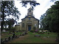
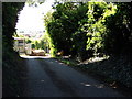
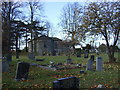
CV3 2HG is a small residential postcode in the Binley and Willenhall area of Coventry, England. Covering just 1.1 hectares, it is densely populated, with 1,369 residents living at a density of 120,521 people per square kilometre. This compact area sits on the eastern edge of Coventry, where Binley evolved from a 11th-century mining village into a modern residential hub. The postcode includes both private homes and council properties, reflecting its long history as a working-class community. Binley’s roots stretch back to the Domesday Book, with the Coombe Estate shaping its development. Today, the area is defined by its proximity to retail, transport, and green spaces, offering a mix of convenience and historical character. Residents benefit from nearby schools, rail links, and the legacy of Binley Colliery, now repurposed as industrial land. The high home ownership rate (87%) suggests a stable, long-term community, with most properties being houses rather than flats. Living in CV3 2HG means navigating a tight-knit, mature demographic with strong local ties to heritage and infrastructure.
- Area Type
- Postcode
- Area Size
- 1.1 hectares
- Population
- 1369
- Population Density
- 5561 people/km²
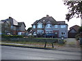
The property market in CV3 2HG is dominated by owner-occupied homes, with 87% of properties being owned by residents rather than rented. This high home ownership rate suggests a stable, long-term community with limited turnover. The accommodation type is primarily houses, which is typical for areas with mature demographics and limited development. Given the small area size (1.1 hectares) and high population density, the housing stock is likely to be tightly packed, with little scope for new builds. For buyers, this means a market focused on existing properties rather than new developments. The prevalence of houses over flats may appeal to those seeking family homes or larger living spaces. However, the limited land area and high density could pose challenges for expansion, making the immediate surroundings critical for property seekers. The market is likely to be competitive, with demand concentrated among existing residents looking to upgrade or downsize.
House Prices in CV3 2HG
Showing 21 properties
| Address | Type | Beds | Baths | Last Sale Price | Last Sale Date | |
|---|---|---|---|---|---|---|
| 55 Princethorpe Way, Coventry, CV3 2HG | Terraced | 3 | 1 | £212,500 | Mar 2025 | |
| 83 Princethorpe Way, Coventry, CV3 2HG | Semi-detached | 2 | 1 | £280,000 | Mar 2024 | |
| 71 Princethorpe Way, Coventry, CV3 2HG | Semi-detached | 3 | 2 | £225,650 | Jan 2018 | |
| 89 Princethorpe Way, Coventry, CV3 2HG | Semi-detached | 2 | 1 | £185,000 | Jul 2017 | |
| 85 Princethorpe Way, Coventry, CV3 2HG | Semi-detached | 4 | 2 | £257,000 | Sep 2016 | |
| 67 Princethorpe Way, Coventry, CV3 2HG | Semi-detached | 3 | - | £199,000 | Aug 2016 | |
| 79 Princethorpe Way, Coventry, CV3 2HG | Semi-detached | 3 | - | £159,000 | Jul 2014 | |
| 57 Princethorpe Way, Coventry, CV3 2HG | house | 4 | 1 | £124,999 | Oct 2010 | |
| 63 Princethorpe Way, Coventry, CV3 2HG | Terraced | - | - | £163,000 | Apr 2006 | |
| 61 Princethorpe Way, Coventry, CV3 2HG | house | - | - | £134,950 | Aug 2005 |
Energy Efficiency in CV3 2HG
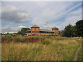
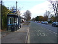
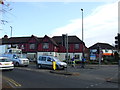
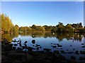
Residents of CV3 2HG have access to a range of amenities within practical reach. The area is served by five retail outlets, including Lidl Binley, Morrisons Binley, and Asda Living, providing everyday shopping options. Nearby rail stations connect to Coventry and beyond, while the proximity to Coventry Airport offers additional travel flexibility. Though the data does not mention parks or leisure facilities directly, historical references highlight green spaces such as Brandon Wood and Willenhall Wood, which may be accessible to residents. The Village Green in Binley, established in 1989, offers a communal space for local events and recreation. The blend of retail, transport, and green spaces creates a lifestyle that balances convenience with access to nature and community hubs.
Amenities
Schools
The nearest school to CV3 2HG is Ernesford Grange Primary School, which holds an Ofsted rating of ‘good’. This primary school serves the local community, providing education for younger children in the area. The absence of secondary schools or other educational institutions in the immediate vicinity means families may need to travel slightly further for secondary education. However, the ‘good’ rating at Ernesford Grange indicates a reliable foundation for early learning. The school’s presence contributes to the area’s appeal for families with young children, though the lack of a broader range of schools could be a consideration for those requiring multiple educational options. The focus on primary education aligns with the area’s mature demographic, where many residents may have children in this age group.
| Rank | School | Type | Entry gender | Ages |
|---|
Explore more schools in this area
Go to Schools tabDemographics
The population of CV3 2HG has a median age of 47, with the majority of residents falling within the 30–64 age range. This indicates a community of established adults, many of whom are likely to be homeowners. Home ownership is exceptionally high at 87%, reflecting a preference for long-term residency over rental properties. The area is predominantly composed of houses, which aligns with the demographic profile of older, settled households. The predominant ethnic group is White, though no specific data on diversity or deprivation is available. The age distribution suggests a mature population with limited representation of younger families or retirees, which may influence local services and amenities. The high home ownership rate and age profile imply a community focused on stability and continuity, with fewer transient residents. This demographic structure may affect the character of the area, fostering a sense of familiarity among neighbours.
Household Size
Accommodation Type
Tenure
Ethnic Group
Religion
Household Composition
Age
Household Deprivation
NS-SEC
Explore more demographic insights in this area
Go to Demographics tabPlanning
Planning Constraints
- Flood RiskPremium
- Ramsar Wetland SitesPremium
- Area of Outstanding Natural BeautyPremium
- Protected Nature ReservePremium
- Protected WoodlandPremium