Area Overview for CV3 2GJ
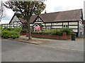
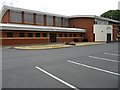
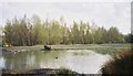
Photos of CV3 2GJ
Area Information
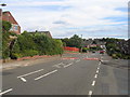
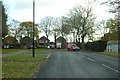
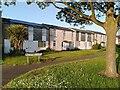
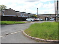
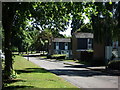
CV3 2GJ lies in the south-eastern part of Coventry, within the Binley and Willenhall area, a historic residential cluster shaped by its coal-mining past. This small postcode area, covering 4,603 square metres, is densely populated, with 1,369 residents packed at a density of 297,389 people per square kilometre. The community is predominantly composed of owner-occupied homes, with 87% of properties in private hands, reflecting a stable, long-term resident base. Most residents are adults aged 30–64, with a median age of 47, suggesting a mature, established population. The area’s proximity to Coventry’s urban core, combined with its historical roots as a mining village, creates a unique blend of traditional charm and modern convenience. Residents benefit from nearby schools, rail links, and retail hubs, while the surrounding landscape includes pockets of green space like Brandon Wood. Though compact, CV3 2GJ offers a self-contained lifestyle with easy access to the wider city’s amenities, making it appealing to those seeking a balance between suburban tranquillity and urban connectivity.
- Area Type
- Postcode
- Area Size
- 4603 m²
- Population
- 1369
- Population Density
- 5561 people/km²
The property market in CV3 2GJ is dominated by owner-occupied homes, with 87% of properties in private hands. This high rate of home ownership suggests a stable, long-term resident base with little turnover. The accommodation type is exclusively houses, not flats, reflecting the area’s traditional residential layout. Given the small size of the postcode area—just 4,603 square metres—and the high population density, the housing stock is likely limited to a small number of properties. Buyers should consider the proximity to amenities such as schools, rail stations, and retail hubs, which may enhance the area’s appeal. However, the compact nature of the postcode means that property availability could be constrained, and buyers may need to look beyond immediate surroundings for more options. The mix of private and council-owned homes indicates a blend of older and newer properties, potentially offering a range of price points and styles for buyers.
House Prices in CV3 2GJ
Showing 16 properties
| Address | Type | Beds | Baths | Last Sale Price | Last Sale Date | |
|---|---|---|---|---|---|---|
| 7 Willoughby Close, Coventry, CV3 2GJ | house | - | - | £235,000 | Aug 2025 | |
| 8 Willoughby Close, Coventry, CV3 2GJ | Terraced | 3 | 1 | £185,000 | May 2021 | |
| 11 Willoughby Close, Coventry, CV3 2GJ | house | - | - | £119,000 | Apr 2011 | |
| 4 Willoughby Close, Coventry, CV3 2GJ | house | - | - | £120,500 | Oct 2010 | |
| 1 Willoughby Close, Coventry, CV3 2GJ | Terraced | - | - | £124,000 | Jul 2007 | |
| 12 Willoughby Close, Coventry, CV3 2GJ | Terraced | - | - | £72,000 | Jan 2007 | |
| 16 Willoughby Close, Coventry, CV3 2GJ | Terraced | - | - | £133,000 | Jun 2006 | |
| 2 Willoughby Close, Coventry, CV3 2GJ | Terraced | 3 | - | £66,450 | Jul 2001 | |
| 10 Willoughby Close, Coventry, CV3 2GJ | Terraced | 3 | 1 | £57,000 | Mar 2000 | |
| 15 Willoughby Close, Coventry, CV3 2GJ | house | - | - | - | - |
Energy Efficiency in CV3 2GJ
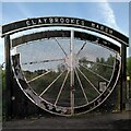
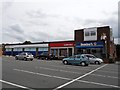
Residents of CV3 2GJ have access to a range of amenities within practical reach. The area includes five retail venues, such as Heron Willenhall, Lidl Binley, and Morrisons Binley, offering everyday shopping needs. Nearby green spaces include Brandon Wood, an ancient woodland accessible to the public, and Willenhall Wood, a designated nature reserve. These spaces provide opportunities for walking, cycling, and outdoor recreation. The area also features a Village Green, established in 1989, used for community events and children’s activities. Social hubs like the Coombe Social Club, which has served the area since 1929, add to the local character. The presence of a well-rated primary school, Ernesford Grange, and proximity to rail stations further enhance the area’s appeal, creating a balance between convenience, greenery, and community engagement.
Amenities
Schools
The nearest school to CV3 2GJ is Ernesford Grange Primary School, which holds a ‘good’ Ofsted rating. This primary school serves the local community, providing education for younger children in the area. While no secondary schools are listed in the data, the presence of a well-rated primary school is a significant advantage for families with young children. The school’s rating suggests a standard of education that meets or exceeds national benchmarks, though parents may need to consider additional options for secondary schooling. The absence of further educational institutions in the immediate vicinity means that families may need to look to nearby areas for secondary education. Nonetheless, Ernesford Grange Primary School contributes to the area’s appeal as a family-friendly neighbourhood with accessible schooling.
| Rank | School | Type | Entry gender | Ages |
|---|
Explore more schools in this area
Go to Schools tabDemographics
The population of CV3 2GJ is 1,369, with a median age of 47, indicating a community skewed towards middle-aged and older adults. The most common age range is 30–64, suggesting a workforce-focused demographic with strong ties to the area. Home ownership is exceptionally high at 87%, reflecting a stable, long-term resident base with few renters. The accommodation type is predominantly houses, not flats, which aligns with the area’s traditional residential character. The predominant ethnic group is White, though no specific data on diversity or deprivation is provided. The high population density—297,389 people per square kilometre—suggests tightly packed housing, yet the area remains residential rather than commercial. This density may influence local services and community dynamics, but the data does not indicate any specific challenges related to overcrowding or resource strain. The demographic profile points to a community with strong property equity and a focus on settled, family-oriented living.
Household Size
Accommodation Type
Tenure
Ethnic Group
Religion
Household Composition
Age
Household Deprivation
NS-SEC
Explore more demographic insights in this area
Go to Demographics tabPlanning
Planning Constraints
- Flood RiskPremium
- Ramsar Wetland SitesPremium
- Area of Outstanding Natural BeautyPremium
- Protected Nature ReservePremium
- Protected WoodlandPremium